
The 5 most beautiful hikes in Asturias – tips with GPS
- Feb 5
- 3 min read
Asturias lies in the green north of Spain, nestled between the rugged Atlantic coast and the Picos de Europa.
The region is a paradise for hikers : high mountains, dramatic coastal paths and even traces from the time of the dinosaurs await you.

In this blog post I present my five favorite hikes in Asturias – you can follow all of them directly, the GPS data can be found on Outdooractive .
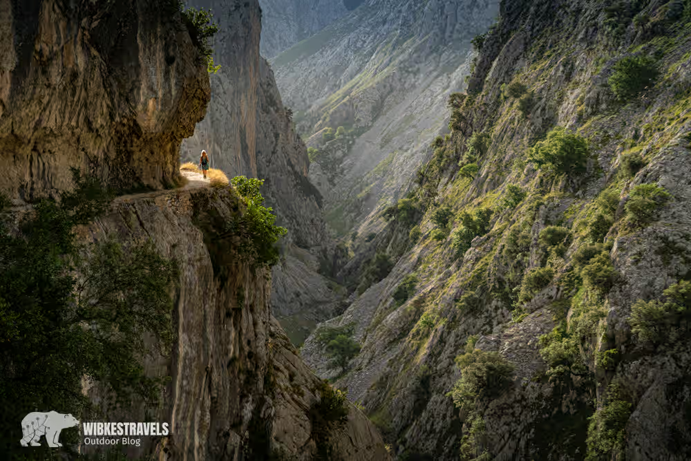
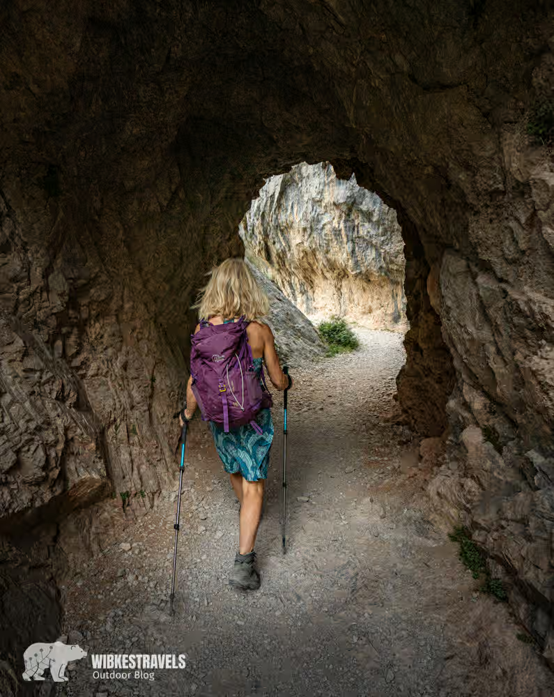
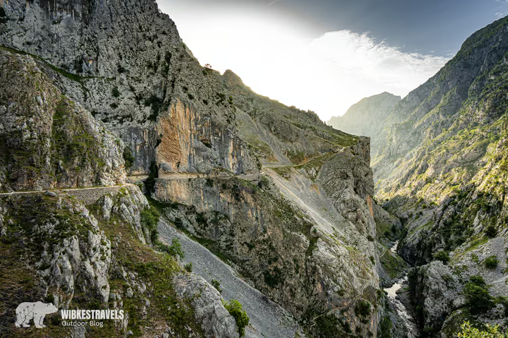
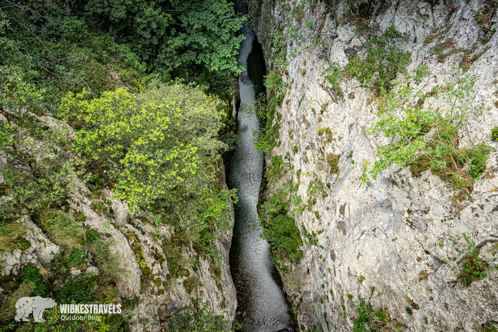
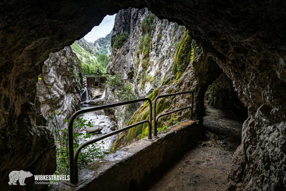
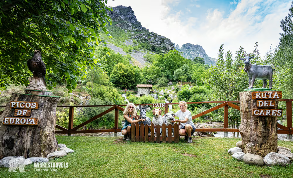
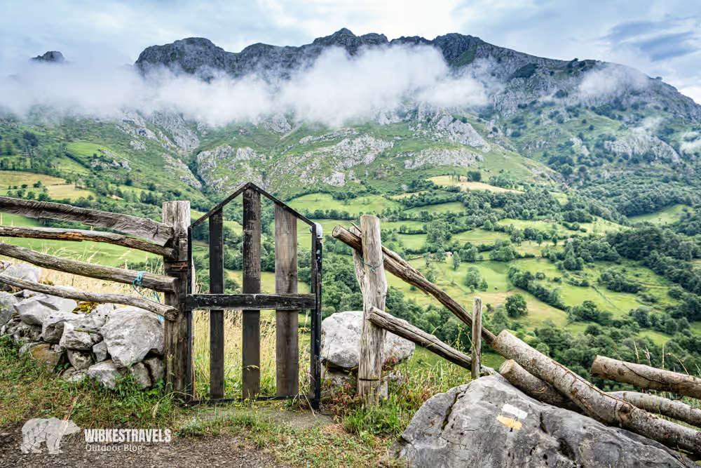
1. Ruta del Cares – Picos de Europa
My tip: Getting up early is worthwhile if you want to enjoy the magic of this great hike in peace.
Check here before hiking to see if the path is open.
One of the most adventurous and spectacular hikes in Spain!
The Ruta del Cares runs high above the Cares Gorge, exposed along the cliffs.
Distance & duration: approx. 12 km one way (23 km round trip), 3:30 h one way.
Difficulty level: moderate. Although the trail is not particularly technically demanding (apart from a few inclines), the hike is quite long if you do it there and back in one day, and therefore requires time and planning. The path is sometimes very narrow and exposed.
Highlight: dramatic gorges and roaring rivers
⬇️ Check out the video I took while hiking the Ruta del Cares, at the bottom of the page!
Click on the first image to start the photo gallery:
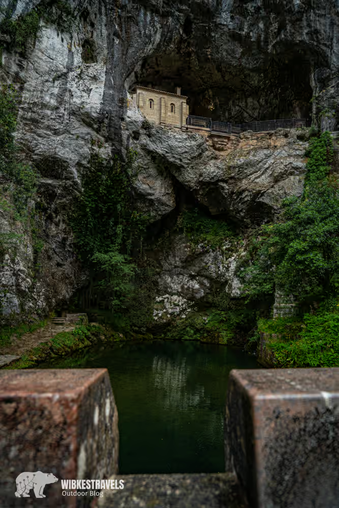
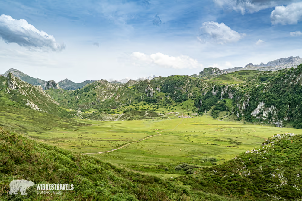
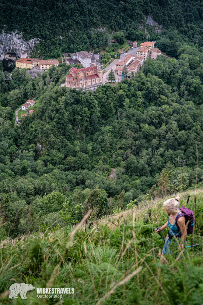
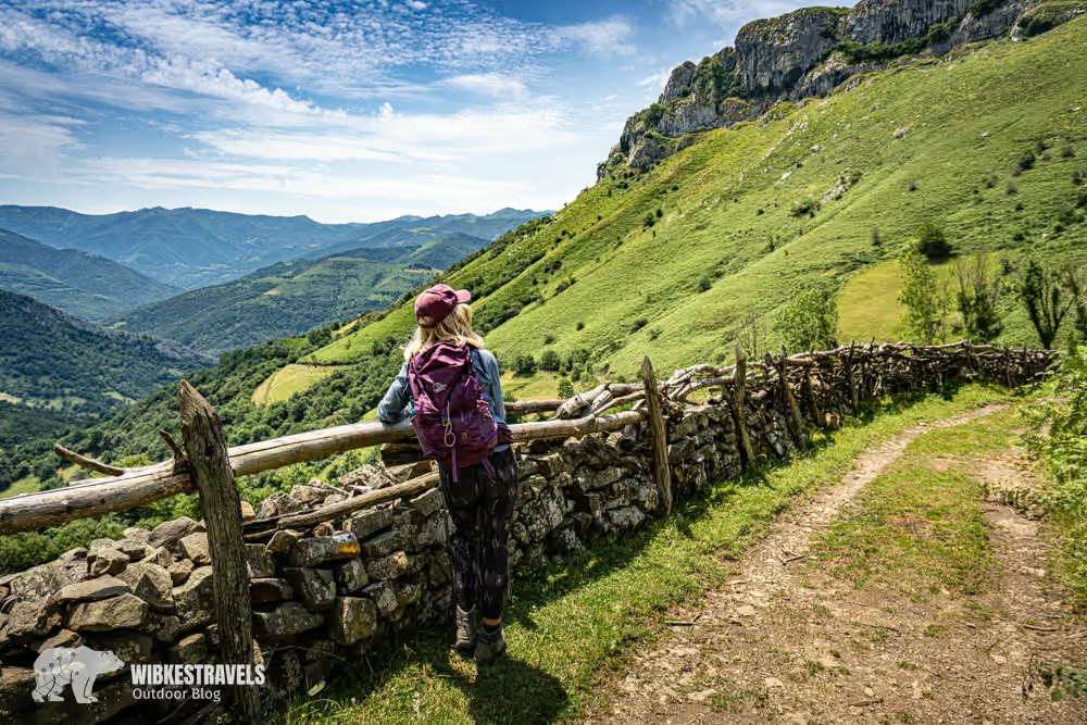
2. Lakes of Covadonga

The long circular hike to the Covadonga lakes offers fantastic mountain panoramas. The glacial lakes Enol and Ercina lie in the breathtaking setting of the Picos de Europa. The hike up from the valley offers tranquility away from the tourist crowds.
Distance & duration: approx. 24.7 km, 9:40 h
Difficulty level: Hard
Highlight: the emerald green mountain lakes and alpine meadows
My tip: Be sure to visit the Basilica of Covadonga at the starting point of the hike! From here, under King Pelayo, the reconquest of Spain began.
Click on the first image to start the photo gallery:
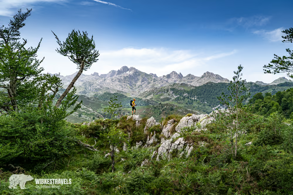
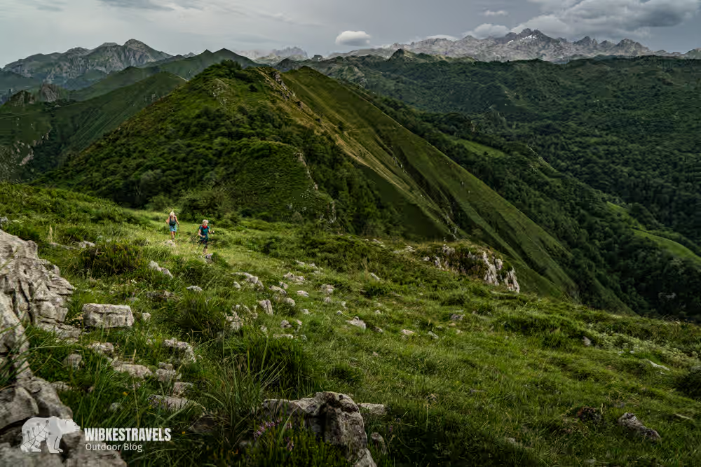
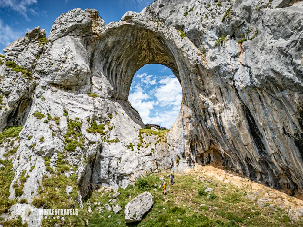
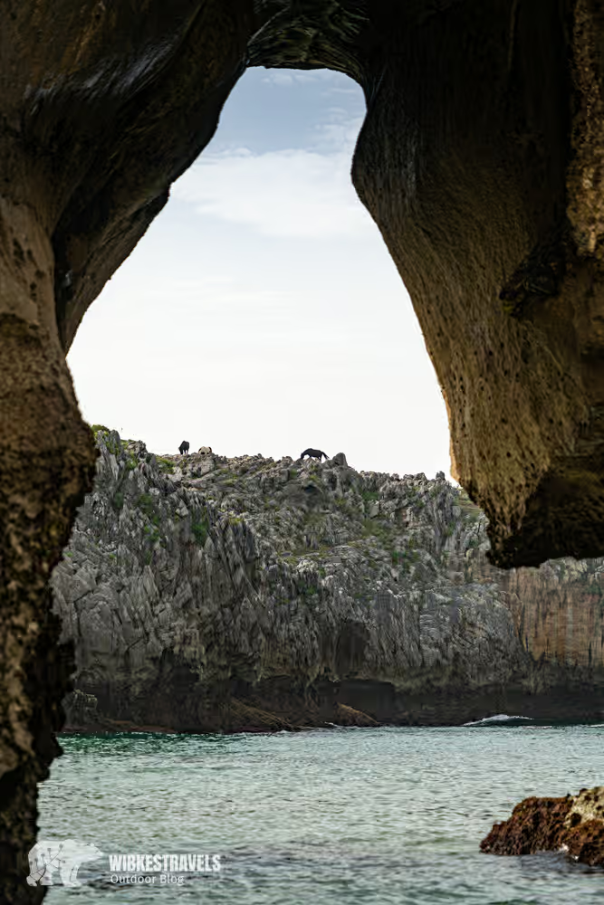
3. Summit of Peña Mea
Those who climb Peña Mea will pass the impressive rock window “Ojo de Buey” .
Distance & Duration: approx. 10 km, 4 hours
Difficulty level: challenging
Highlight: 360° panorama of mountains and coast
The eye in the rock would definitely be a top Instagram spot if the climb weren't so strenuous 😀
Click on the first image to start the photo gallery:
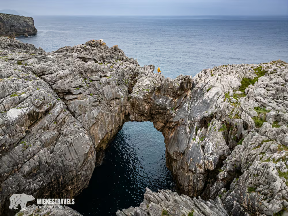
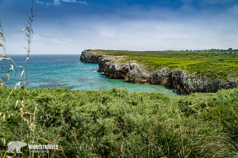
4. Coastal hike Ribadesella – Cuevas del Mar
A picturesque coastal hike leads from Ribadesella to the Cuevas del Mar.
Distance & Duration: approx. 18.5 km, 6 hours
Difficulty level: difficult. Even though there are no steep mountains, the path is long and rocky – the views are magnificent.
Highlight: hidden beaches, cliffs and the roaring sea
Especially during the winter months and stormy seas, the Bufones de Pría offer a true natural spectacle that should not be missed.
Click on the first image to start the photo gallery:
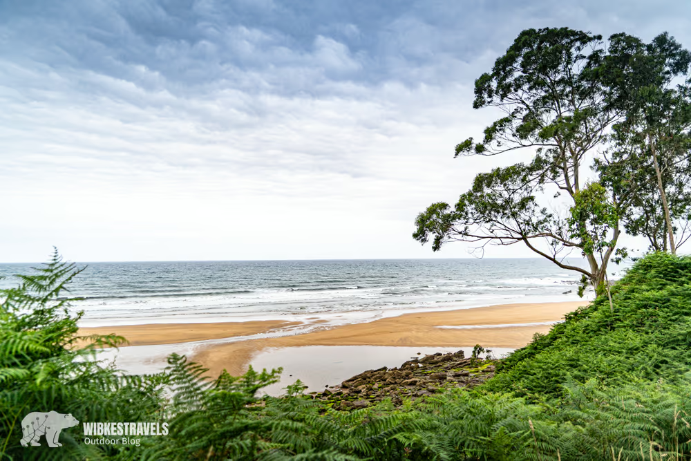
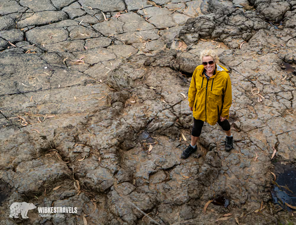
5. On the trail of the dinosaurs – Playa de La Griega & Playa de La Isla
Between Playa de La Griega and Playa de La Isla, you can walk in the footsteps of dinosaurs .
Distance & Duration: approx. 11.5 km, 4 hours
Difficulty level: medium
Highlight: fossilized dinosaur tracks right by the sea
My tip: Both Playa de La Griega and Playa de La Isla have fantastic beaches. Don't forget your swimwear!
Click on the first image to start the photo gallery:

Asturias offers many more hikes, which I couldn't all cover in one blog post. More articles will follow : my favorite hikes in Somiedo and a hut-to-hut hike in the Picos de Europa .
Video of the Ruta del Cares:


Comments