
Otter Trail South Africa: All stages, GPS data & highlights of the most spectacular coastal hike
- Nov 9, 2025
- 5 min read
Updated: Dec 5, 2025
Planning & Preparation for the Otter Trail in South Africa
👉 Detailed description of each stage with your GPS data and tips.

South Africa's most spectacular hike, the Otter Trail, winds along the pristine coast of the Tsitsikamma National Park on the Garden Route.
It takes five days to cover the 42 kilometers and almost 3,000 meters of elevation gain.
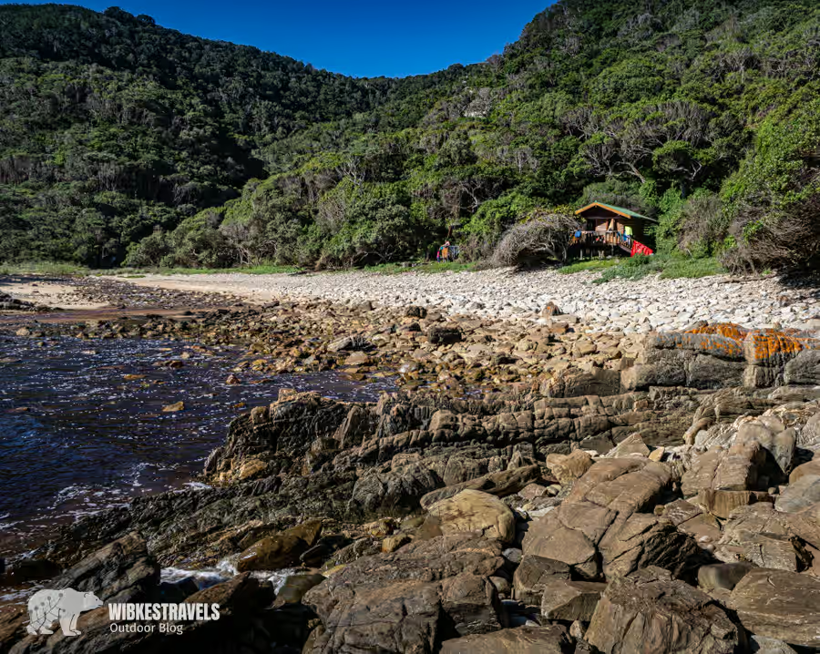
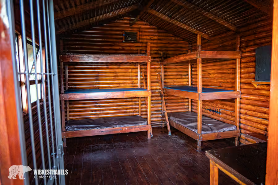
Accommodation is in unstaffed wooden cabins in beautiful locations.

I had to pinch myself every night to make sure I wasn't dreaming.
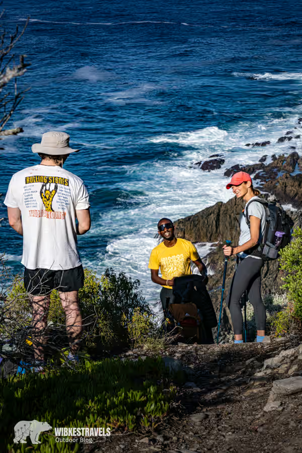
Along the rugged coastline, you'll see exotic flowers like proteas, encounter monkeys (although they pose the greatest threat to your provisions), spot dolphins, sharks, whales, and with a bit of luck, the eponymous otters, swim in romantic tidal pools, and chat with the other 11 lucky people (only 12 people are allowed on the coastal trail each day), who become friends along the way.
Otter Trail South Africa: Here you'll find GPS data and information about the most spectacular coastal hike.
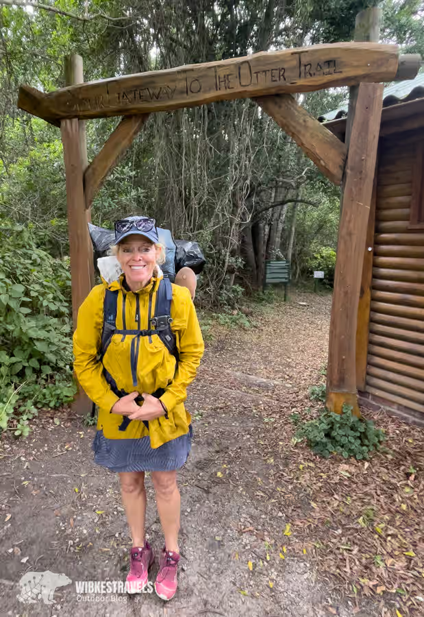
Stage 1: Otter Trail Start to Ngubu Huts – 4.8km (2h)
You must register at the Storms River Park reception to receive your permit, trail map, and briefing, and to watch a short video about recent changes to the trail. The Otter Trail begins near a parking area. Since the first day is short and relatively easy, you can start later, but not too late, as you'll pass some beautiful spots and it would be a shame to rush. The hike begins with a steep descent through the forest until you suddenly reach rocky seafront and a stunning coastal landscape. About halfway through the first day, you'll reach the Jerling River waterfall, which plunges into a large pool. After that, the trail leads through a natural forest up a slope to the Ngubu Huts with their large communal barbecue area.
Stage 2: Ngubu Huts to Scott Huts – 7.9km (4h)
The second day presents the first real challenge, with some steep ascents and descents through the coastal forest; the steps are high and uneven. Climbing to the summit of Skilderkrans (2 km) is highly recommended for the spectacular views. From Skilderkrans, the trail continues with its characteristic ups and downs to the Kleinbos River, with its large pools and steep banks – a rewarding spot for a rest and a swim. Bloubaai beach at kilometer 5 is a fantastic place for a longer break and a short detour in good weather. Returning to the trail, a few more ups and downs lead to the Scott Huts by the sea.
Click on the first image to start the photo gallery.
Stage 3: Scott Huts to Oakhurst Huts – 7.7 km (4h)
This is probably the most beautiful day on the Otter Trail. It follows a spectacular stretch of coastline with wooded sections, several streams, and a lovely tidal pool. The terrain is somewhat easier than the previous day. It's advisable to cross the Lottering River at low tide. After crossing the river, it's not far to the Oakhurst cabins. It's worth arriving before sunset to explore the area.
Stage 4: Oakhurst Huts to Andre Huts – 13.8 km (6h)
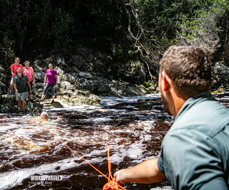
The fourth day presents the greatest challenge, both in terms of distance and river crossings. The first 10 km lead through forests and dramatic stretches of coastline before the famous crossing of the Bloukrans River. It is crucial to cross the Bloukrans at low tide, which may mean setting off before dawn. Even at low tide, the river will likely need to be swum across, and a survival bag to hold your backpack is essential. If the river is in flood or you arrive at high tide and the sea is rough, it is advisable to use the escape route (see map).
Stage 5: Andre Hütten to Nature's Valley – 9.5 km (5h)
The day begins with a short walk along a rocky beach and a steep climb to the plateau. From here, the trail continues mostly across the plateau through easy terrain with plenty of fynbos and heather. Keep an eye out for king proteas. There are some good viewpoints on the spectacular cliffs as you approach "The Point." The panoramic view of the Groot River estuary and Nature's Valley beach signals the end of the Otter Trail. After the descent, the trail turns right off the beach and continues for 4 km through the forest and across small streams to De Vasselot in Nature's Valley.
.
info
General information on accommodation, activities and travel planning can be found on the website www.southafrica.net/de/de/travel .
All information about the Otter Trail can be found on the South African National Parks (SANParks ) website. The trail must also be booked there.
On the Sanparks website, spots are usually booked up for more than a year. A slightly more expensive alternative is Starthikingtoday , which also offers guided tours. Additionally, you can book the hike as a slackpacking trip (luggage transport from hut to hut) and hire a guide.
Attention: A medical certificate is required for the trail; the form can be downloaded from the Sanparks website. There is also an age restriction of 12 to 65 years.
Difficulty of river crossings and safety
The trail itself (apart from the river crossings) isn't particularly difficult, and the daily stages are planned so that reasonably fit hikers could actually reach the next hut by early afternoon. Which would be a shame, because there are many beautiful spots along the way that invite you to linger.

Caution is advised when crossing some rivers and streams. Even small rivers can be dangerous after heavy rainfall. The Lottering, Elandsbos, and especially the Bloukrans rivers should only be crossed at low tide . Check the tide times before your trip. Be sure to bring a large, sturdy plastic bag (survival bag) in which your backpack can float. If in doubt, take one of the six escape routes.
Arrival
Tsitsikamma National Park is located roughly halfway between Cape Town and Gqbhera/Port Elizabeth airports . Direct flights to Cape Town are available with airlines such as Condor and Lufthansa.
The most convenient way to reach the starting point of the hike is by rental car, available at the SANParks reception on Storms River www.billiger-mietwagen.de .
Transfers back to the starting point can be booked here :

Best time
The best time is when you can get a spot.
All joking aside: The Otter Trail is accessible year-round. The average temperature is between 15 and 22 degrees Celsius.
Map material
A detailed hiking map will be handed out at the briefing before the start of the hike.
equipment
The backpack should weigh no more than 25-30% of the body weight.
Well-broken-in hiking boots – I hiked in trail running shoes and even wore them for the river crossing. Depending on the season, also bring warm and weatherproof clothing, a sleeping bag, a waterproof bag for valuables, a backpack with a rain cover, packing your belongings in plastic bags, and a survival bag. Stove and camping cookware, water bottle and provisions for the entire hike. Hiking poles, a map, rope (for clotheslines and river crossings), a first-aid kit, a mobile phone, toilet paper, and shoes for camping.
Hiking Trail Transfers offers the option to rent a complete backpack with equipment or just individual items. They also offer a shuttle service back to your car and the slackpacking option.


Comments