
Peaks of the Balkans - Multi-day hike through the mountains of Montenegro, Albania and Kosovo
- May 1, 2025
- 9 min read
The multi-day Peaks of the Balkans hike requires good physical fitness and a bit of planning. Here you'll find information, tips, and GPS data for all stages.

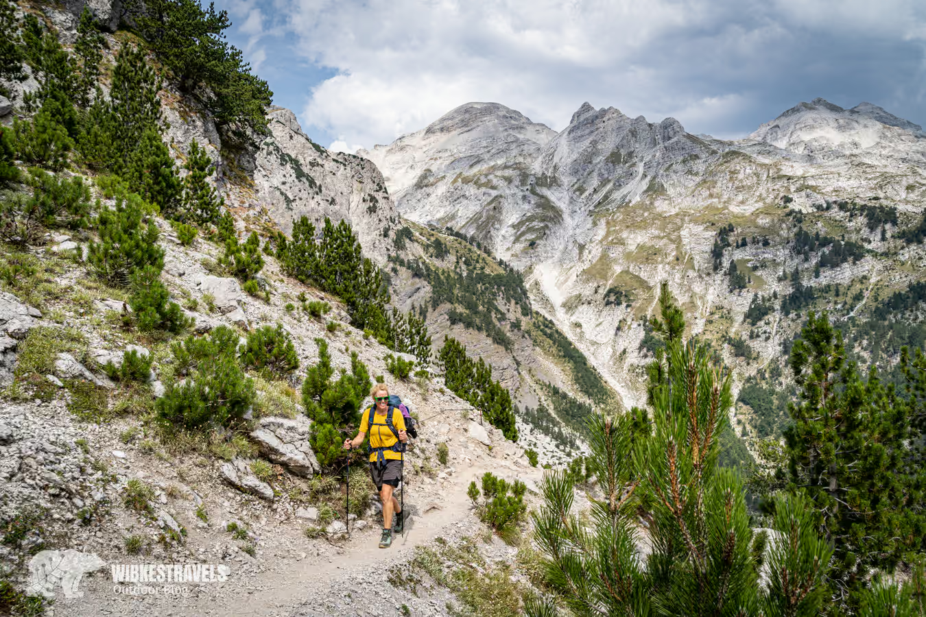
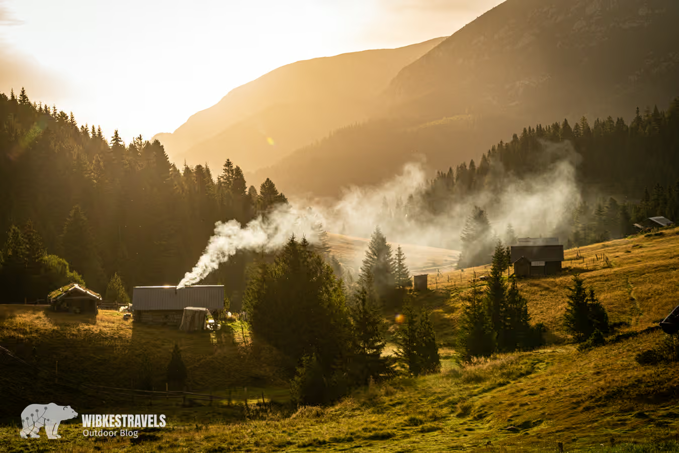
3 countries, 10 days, approximately 200 km, and nearly 10,000 meters of elevation gain. The Peaks of the Balkans hiking trail was created to halt rural exodus in Albania, Kosovo, and Montenegro and to secure peace in this formerly troubled region. The result is an extremely diverse, multi-day hike through the so-called "accursed" mountains of the Dinaric Alps , which was worth every meter for my sister and me. We stayed in a variety of accommodations, with a variety of hosts, and slept with a variety of people from a variety of countries. We heard sad, interesting, funny, and beautiful stories and were able to dispel many prejudices.

How difficult is the Peaks of the Balkans?
The hike consists of ten stages, almost all of which are relatively strenuous, covering more than 20 km and mostly with more than 1,000 meters of elevation gain. You'll need to be in good shape. Since you can stay overnight in huts, you won't have to carry too much gear. It gets really strenuous if you camp and have to lug all your gear around.
Can you do the Peaks of the Balkans on your own?
We found the hike to be relatively well signposted. However, I had downloaded the GPS data onto my phone beforehand, and there were a few places where I had already checked. I did the hike with my sister in the first week of September, and there were already quite a few people out there. Whether you can do the trail alone depends a bit on your orientation and fitness. And of course, the weather also plays a role. We met a few hikers on the trail who were doing the hike completely alone. But we also saw organized groups. If you're unsure, you can book the tour with the DAV Summit Club , for example .

What equipment do I need to take with me to the Peaks of the Balkans?
The Peaks of the Balkans, also known as the POB, is a challenging, multi-day hike, even at higher altitudes. It can be done as a hut-to-hut hike or with a tent. Essential items include a trekking backpack (approx. 20-50 liters) with a rain cover, sturdy, comfortable, broken-in footwear, durable, layered clothing and a change of clothes (in a waterproof pack), sun and rain protection, a first-aid kit, maps and/or an app, ID, cash (we got by with just euros), telescopic poles, a water bottle (we had a water filter, and otherwise chlorine tablets as a backup), a cell phone and charger, and a headlamp.
Those who don't want to stay in huts will need additional camping equipment (tent, sleeping pad, sleeping bag, and cooking equipment). There are no supermarkets except in Plav, Gusinje, and Teth. However, it is possible to get something to eat at most accommodations.
What do the stages on the Peaks of the Balkans look like?
You can see the entire route here on Outdooractive . I found it very clear and helpful for planning.
You can start the Peaks of the Balkans from Teth, Plav, or Rekë e Allagës . We started the hike in Montenegro at Lake Plav. We thought this order was great, but it does mean you have three relatively tough days with a lot of elevation gain right at the beginning. Most people start from Teth in Albania. I've sorted the stages (with GPS data) accordingly:
6:15 hrs, 1220 m ascent, 1040 m descent

The section between Teth and Valbona is the most frequently traveled of the entire trail. Many day trippers combine this hike with a boat trip on Lake Koman. It can get crowded here: women clad only in sports bras and leggings, and men in white sneakers posing for selfies at every turn. At the Qafa e Valbonës pass, a queue has already formed for the obligatory photo op high above the valley. The view is beautiful, the circumstances less so, and we continue quickly. On the descent, we encounter mules and horses laden with suitcases. This section has little in common with the hoped-for pristine Peak of the Balkans.
Sleep: We found Guesthouse Dioni to be perfectly fine. The accommodation is located relatively high up in the valley, in the forest, but only 50 meters from the Valbona Valley, where you can watch the sunset.

4 hours, 670 meters ascent, 410 m descent
This stage is certainly not one of the most beautiful. It runs along a relatively long, heavily trafficked asphalt road. Then it climbs steeply up the mountain, where, at least in our case, a forest fire has just charred most of the trees. Çerem is, however, a nice little village where it's nice to spend the night.
Option 1: If you are short on time, you can do stages 2 and 3 in one day by taking a ride from Valbona to the bridge.
Variant 2: From Valbona, a longer (and more strenuous) variant leads over Montenegro's highest mountain, Zla Kolata, 2534 m, to Çerem.
Sleep: the VITA Guesthouse The signs are pretty obtrusive, but the owner, Tatjana, is super nice and the rooms are bright and clean. The shared meals were also good. You can see their luxury cabins on the left.
6 hours, 1290 meters ascent, 680 m descent
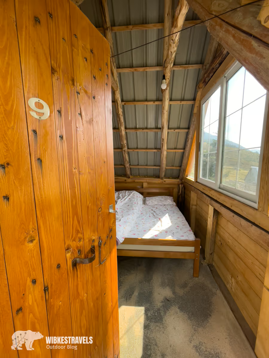
The hike to Dobërdol is relaxing and beautiful. This remote valley, where shepherds graze their animals in the summer and tourists can stay overnight in simple wooden huts, is part of the wildest part of the Peaks of the Balkans Trail and an absolute highlight for most hikers. It's not so bad if you arrive in the early afternoon; it's a great place to while away the time. At night, I could see the Milky Way from my bed, while sheep bells gently lulled me to sleep.
Sleep: The Doberdol Guesthouse Bashkimi is one of my favorite accommodations. Reservations via WhatsApp: +35858694747158147069
Tip: Room number nine has a view of the starry sky
Click on the first image to see it in large:
7 hours, 1060 meters ascent, 1180 m descent
Certainly one of the most beautiful stages of the trail! The next day, after the ascent to the three-country peak of Trekufiri, the trail continues along a ridge path through the wild, blueberry-covered mountains.

Extra day: Kosovo's highest mountain, Gjeravica at 2656 m, can be climbed in a day trip from Dobërdol.
Sleeping: Chalet Rrusta is more reminiscent of a Swiss mountain hut than a house in the Balkans. The son is an architect in Switzerland, and it shows. The rooms are super clean and super nice. The location above the valley is also fantastic.
6 hours, 970 meters ascent, 1360 m descent
After a short climb, the long and steep descent into the Rugova Valley begins.
Tip: Shortly before Rekë e Allagës The Myths and Waterfall Trail begins on the left and is worth a detour as there is a beautiful waterfall here.
Sleeping: Unfortunately, we didn't sleep at Pushimorja Hajla , but we heard it's very nice. Reservations via WhatsApp +37744678668
Click on the first photo:
7:30 hrs, 1420 m ascent, 1310 m descent

Option 1: If you want/have to skip a stage, you can take a taxi directly from the Rugova Camp Hotel (stage 5) to Guri i Kuq.
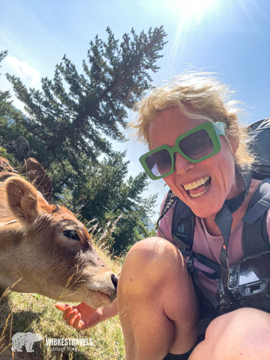
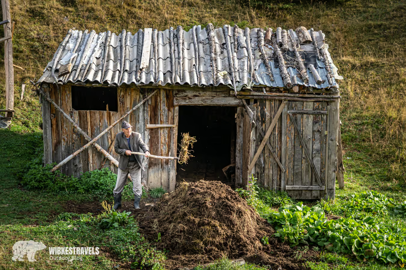
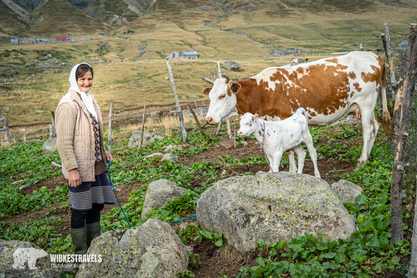
The villages of Rekë e Allagës, Pepaj, and Drelaj offer a good insight into rural life in Kosovo . The trail leads past haystacks, wooden houses, mosques, and even a small castle. Farmers and shepherds are happy to chat with hikers.
Otherwise, the original stage 8 is not very attractive, as it mostly runs on roads.
Option 2: A nice alternative from Rekë e Allagës is the ascent of Hajla, 2403 m. After the descent to Drelaj, you can also take a bus/taxi directly to Guri i Kuq, thus saving yourself the walk along the asphalt road.
Sleeping: There are only two guesthouses in Guri I Kuq. We stayed at Villa Liqenat . It was okay.
7 hours, 1220 meters ascent, 1120 m descent
Passing mountain lakes, we head back into the mountains and into Montenegro. Here, colorful meadow flowers bloom on the grassy slopes of the plateau.
Sleeping: The Triangle Woodhouse Unfortunately, there were no rooms available when we were there. But we heard it was fantastic. Contact us via WhatsApp (even in German) +491793886101 or on booking.com.
7:30 hours, 800 meters ascent, 1350 m descent
Another highlight awaits us on the 8th stage: the mystical Hridsko jezero lake , high in the mountains, nestled among ancient conifers. According to legend, it was created so that the forest elves could bathe undisturbed by human gaze. A bath is said to bring health, beauty, and happiness – so let's go!
Sleeping: In Plav, we left our car at Camp Sara for the entire duration of the trail. Apartments are also available for rent here. The campsite has nice and clean restrooms. WhatsApp +382 67 400 872 .

8 hours, 1250 meters ascent, 1180 m descent
At first, the hike out of Plav and up the mountain on wider gravel paths isn't particularly exciting. As the trails narrow, the hike becomes more exciting. The trail takes us to the Gradec ridge, where we finally reach the Katun Paljivukaj high meadow. From here, the path leads steeply and, in places, exposed, up to the peak of Bajrak (2,044 m), where a magnificent view awaits us. Sleeping: Ekoo katun Jezerca 's family was the nicest, the accommodation the most beautiful, and the food the best of our hike.
9:45 hrs, 1150 m ascent, 1400 m descent
Definitely my favorite stage of the entire trail. It climbs through the wide Ropojana Valley into the wild, enchanted mountains. The scenery is simply spectacular, and we're practically alone. After the Peja Pass, the long and steep descent to Teth follows. This doesn't detract from the beauty of the stage.
Sleeping: In Teth, we stayed at the ZEMRA TRADITES inn , as it's located high up in the valley. This saved us a lot of walking down and up. The accommodation itself was fine, and the coffee was great. The portions were a bit sparse, though.
Waymarking
The Peaks of the Balkans long-distance trail is largely well-marked with red and white markings and small white and green signs. Nevertheless, it's recommended to have a GPS device or a mobile phone with a hiking app. The route is subject to frequent changes, so it's best to check the current conditions on site.
A request:
In the Balkan countries, you'll encounter garbage problems almost everywhere . Please don't contribute to these problems and bring a refillable water bottle with you. Water is available everywhere. Except in Kosovo, we didn't filter it. We brought a water filter with us. Chlorine tablets also work as an alternative .
Please take your toilet paper with you when hiking or bury it. Piles of paper in this beautiful natural setting look simply creepy.
Especially on the route between Teth and Valbona, the villages are experiencing a construction boom. Try to stay with local families rather than in large hotels, as this will help support the locals.
info
Detailed information can be found on the websitehttps://peaksofthebalkans.com/ .

There you'll also find the three forms that you need to email to all three countries before the trailhead to cross the green border. We always provided approximate times on the forms. We didn't encounter anyone on the hike who was checked.
Arrival
Those arriving by plane can choose between the airports of Tirana (Albania), Prishtina (Kosovo) , and Podgorica (Montenegro) . By car or bus/train , the easiest way to reach the Peaks of the Balkans is via the three nearest cities: Shkodra (Albania), Peja (Kosovo ), and Plav (Montenegro).
If you want, you can offset the CO2 emissions of your flight, for example with Atmosfair.
Sleep
Most of the hostels along the trail are simple but clean and have showers. Breakfast and dinner are available for a small surcharge.
Accommodations can be found on the Peaks of the Balkans website ( https://peaksofthebalkans.info/guest-houses/ ) or on Booking.com . Since cell phone reception is available almost everywhere, we always booked accommodations a day in advance. This is especially recommended in Dobërdol, as there are limited accommodations there.
Best time
June to the end of October are the best/safest months for hiking. During this time, the risk of snowfields at high altitudes is low, and all accommodations are open.
literature
The Rother hiking guide " Peaks of the Balkans ", updated in 2025, contains not only everything worth knowing about the long-distance hiking trail, including planning, detailed descriptions of the ten daily stages and useful addresses, but also 17 additional tours.
Cards
Hiking map Peaks of the Balkans at a scale of 1:60,000 by Huber Kartographie