
Picos de Europa: 3-day hut-to-hut tour with route, GPS and tips in Spain
- May 2
- 4 min read
Hut-to-hut hiking tours are only found in the Alps? Think again. In the Picos de Europa, nine very different mountain huts await, serving as starting points for challenging hikes through northern Spain. We set out to find out if the "Peaks of Europe" live up to their name.
Asturias is surprisingly green. Rugged limestone mountains give way directly to emerald-green pastures where cows and ponies graze – and the sea awaits just an hour away.
Here you'll find the complete route with my tips and GPS data for the 3-day hut-to-hut hike from Sotres to Poncebos. Overnight stays will be at the Refugio Vega de Urriello, famous among mountaineers and climbers, and at the remote, small Refugio Jou de los Cabrones .
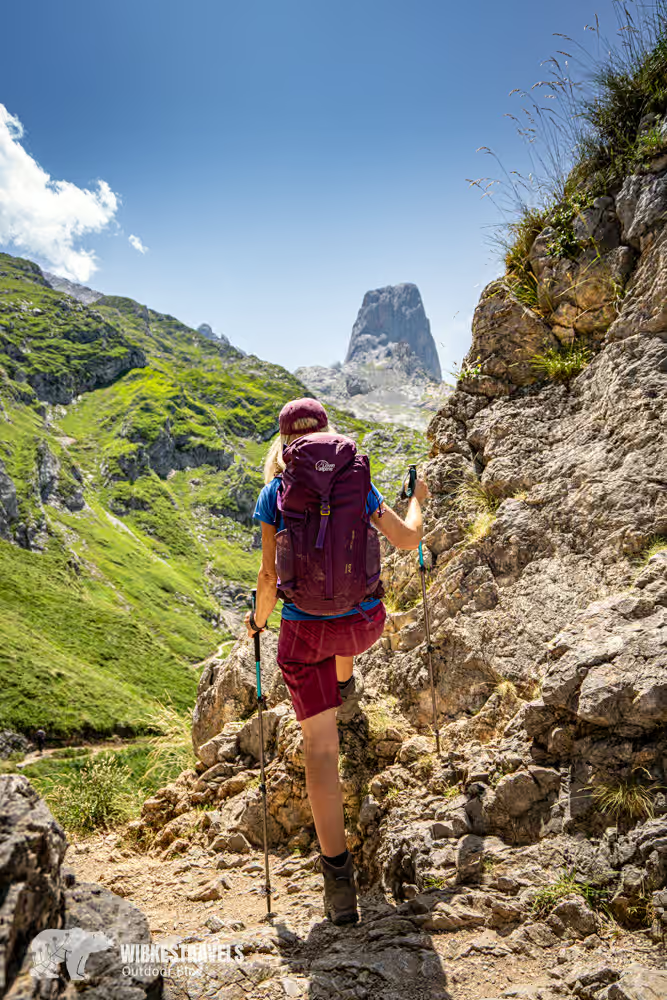
Day 1: From Sotres to Refugio Vega de Urriello

From the mountaineering village to Naranjo de Bulnes
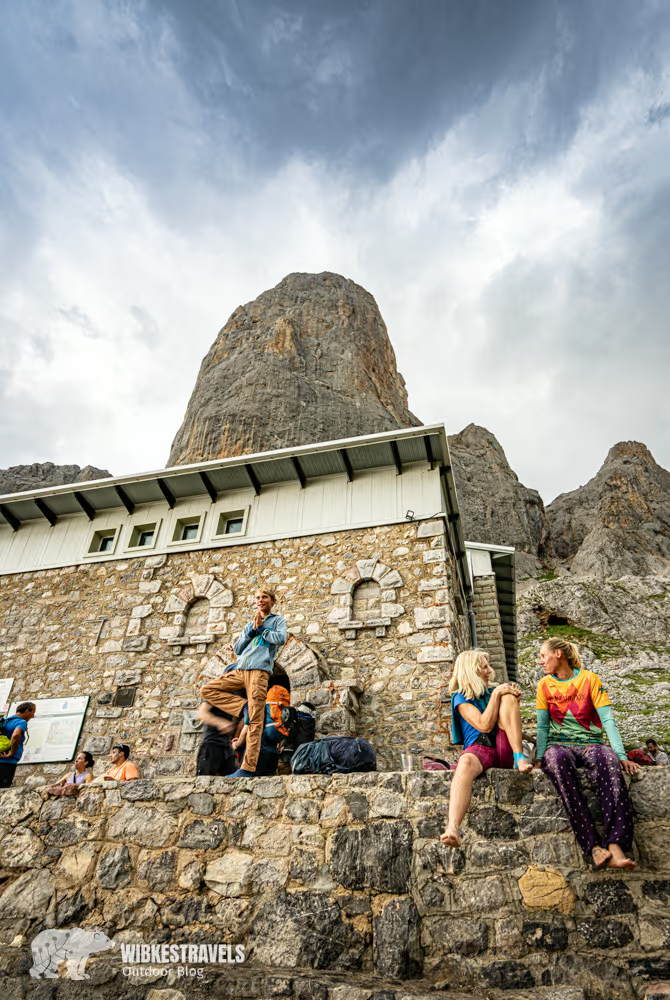
The first day offers everything that makes a perfect hike: alpine meadows, breathtaking views, and a spectacularly situated mountain hut. We start in Sotres and hike across meadows past the Terenosa mountain hut. From Collado Vallejo, we catch our first glimpse of the Naranjo de Bulnes. The Refugio Vega de Urriello lies directly at the foot of this striking peak.
Those who still have energy can explore El Jou de los Boches – a landscape shaped by erosion.
Tip: From the Mirador de Los Jorcaos in Sotres you have a great view of the mountain landscape of the Picos de Europa.
Click on the first image to start the photo gallery:
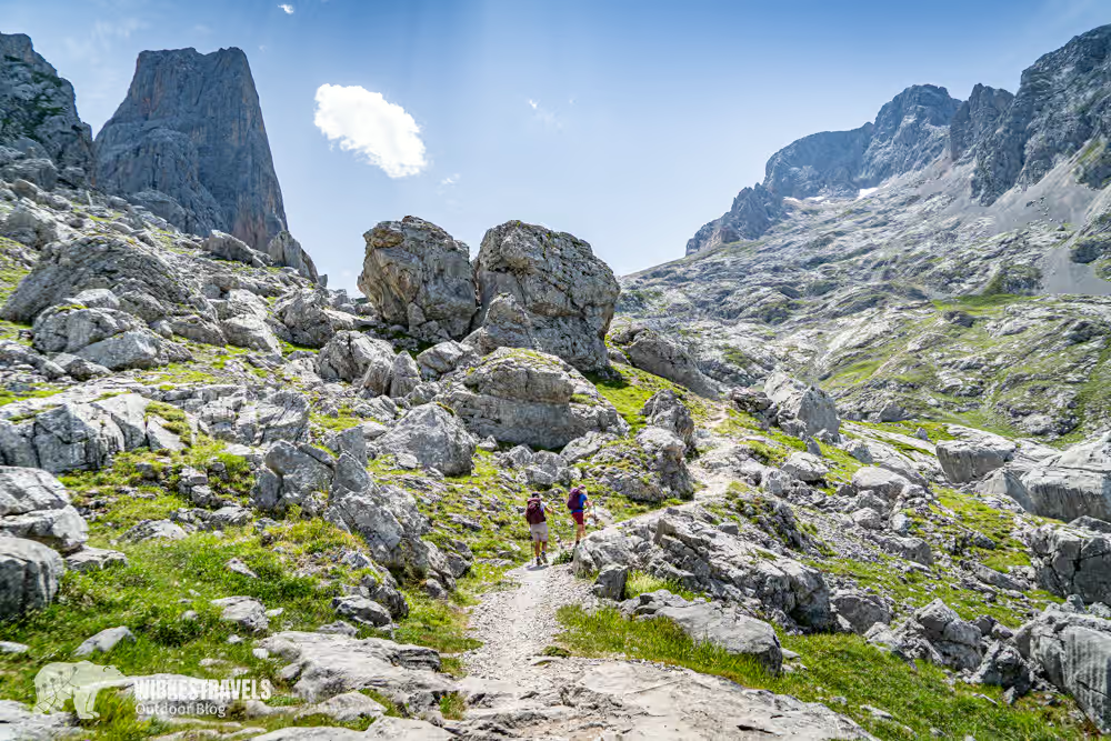
Day 2: From Refugio Vega de Urriello to Refugio Jou de los Cabrones

Through the heart of the Picos de Europa
The second day leads through the high mountains – technically demanding and scenically spectacular.
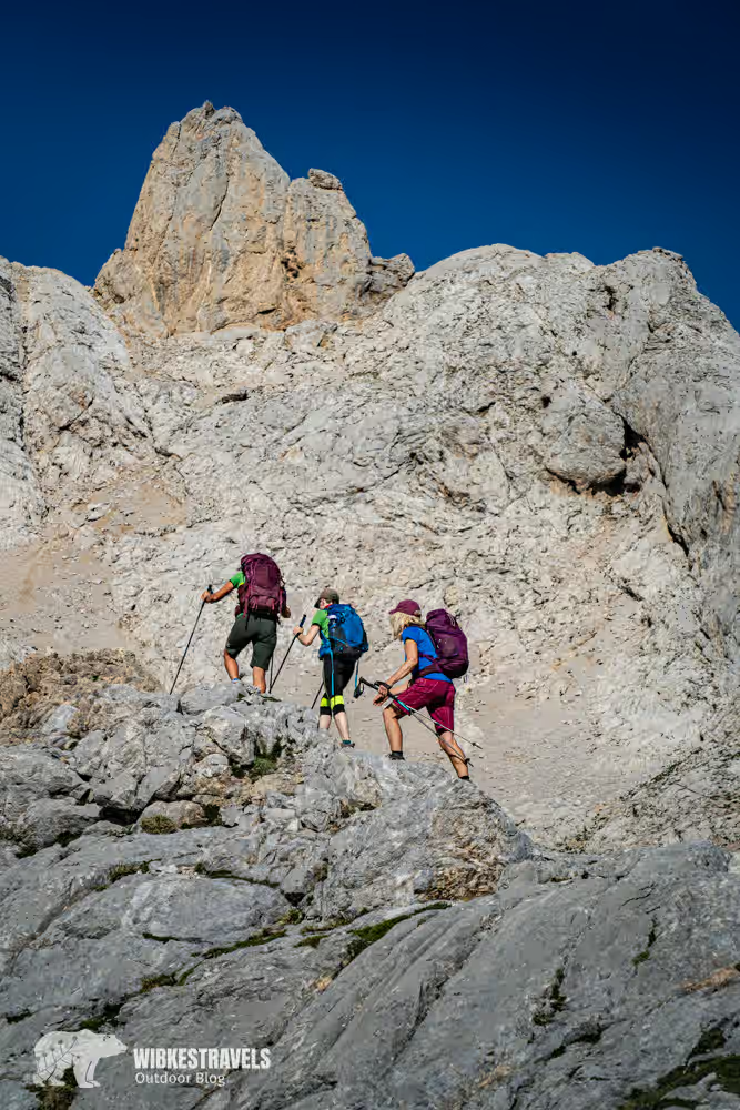
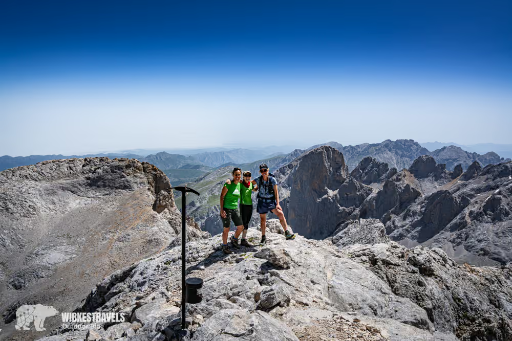
At Corona El Rasu, a short climbing section with iron rungs awaits. From the Hareneras Pass, you can see Torrecerredo (2650 m), the highest peak in the Picos de Europa. Torre de la Párdida (2584 m) is considerably easier to reach and offers a breathtaking panorama.
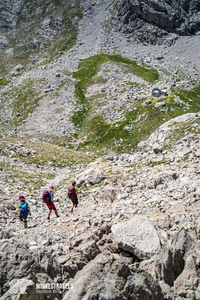
The Refugio Jou de los Cabrones is one of the most remote mountain huts in Spain.
The short walk to the Collada del Agua pass is worthwhile at sunset.
Tip: Sunset at Collada del Agua – one of the highlights of the tour.
Click on the first image to start the photo gallery:
Day 3: From Refugio Jou de los Cabrones to Poncebos

Through gorges back into the valley
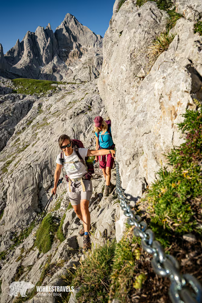
Even on the last day, the route remains challenging, with some secured sections.
The route leads through the Canal de Amuesa gorge to Bulnes – a village without road access.
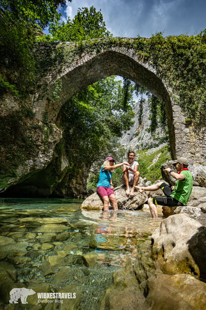
From there, the route continues through the Canal del Texu to the Puente La Jaya.
Tip: Cool off in the river at Puente La Jaya.
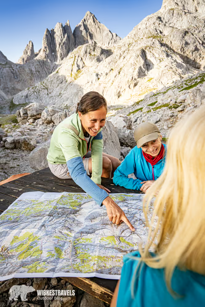
Tips for hut-to-hut hiking in the Picos de Europa
GENERAL INFORMATION
The Picos de Europa National Park website provides information about the park and the current condition of the hiking trails.
Click on the first image to start the photo series for the third day:
ACCOMMODATION
In the Picos de Europa mountains, there are nine mountain huts that can be linked by the "El Anillo de Picos" circular hiking trail . Individual stages can also be combined to create a complete loop. All the information is available on the website, and individual huts can be booked via a link.

HIKING GUIDE
The local provider MSS Mountain offers guided hiking tours with and without overnight stays in mountain huts.
REQUIREMENTS
The Picos de Europa are an excellent, though sometimes challenging, hiking area. Due to the unique topography of the mountain range, even short hikes often involve significant elevation changes.
EQUIPMENT
Sleeping bag liner, hiking boots, layered hiking clothing, rain jacket and trousers, rain cover for the backpack, refillable water bottle, gloves, hat, headlamp.
BEST TIME
Hiking in the Picos de Europa is generally possible from the beginning of June to mid-October. During this time, all mountain huts are open and snowfall is rare, even at high altitudes.
WEATHER
The weather in general, and in the mountains in particular, can change rapidly. Therefore, it is essential to check the weather forecast before embarking on exposed mountain tours.
During the warm summer months, the Picos de Mont Blanc can experience "encainadas" : extremely fast-moving fog banks that appear out of nowhere. These can be so dense that even locals lose their bearings. The best course of action when visibility is poor is to remain still and wait. Often, the fog lifts as quickly as it appeared.
DRINKING WATER
There are plenty of fountains along the hike where you can refill your water bottles.
ARRIVAL
By car: From the French border, take the A-8 (partially toll road) via Bilbao and Santander to Oviedo. From there, take the N-621 towards Arenas de Cabrales.
By bus and train: Take the train ( www.renfe.es ) to Oviedo, then the bus ( www.alsa.es ) to Arenas de Cabrales.
By plane: The nearest airport with several direct connections to Germany is in Bilbao.
Rental cars: Car rental companies can be found at the airports as well as in Oviedo, Santander and Llanes.
LITERATURE
Rother Hiking Guide: Picos de Europa – The most beautiful valley and mountain hikes by Cordula Rabe
And from the same publisher: “Asturias – The most beautiful coastal and mountain hikes” by Susann Heße.
MAPS
Adrados Editions: Picos de Europa – Central & Eastern Massifs (Los Urrieles y Andara), 1:25,000


Comments