
What are the highlights on the Alaska Highway in Canada?
- Jun 19, 2025
- 6 min read
Updated: May 19
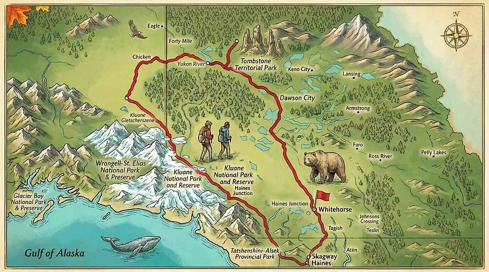
2,224 kilometers of (almost) wilderness, and in the middle of it all, the legendary highway that leads through high mountains, dense forests, past wild animals and massive glaciers through Canada to Alaska, USA. The Alaska Highway isn't just a road; it's a legend. Here are my highlights.

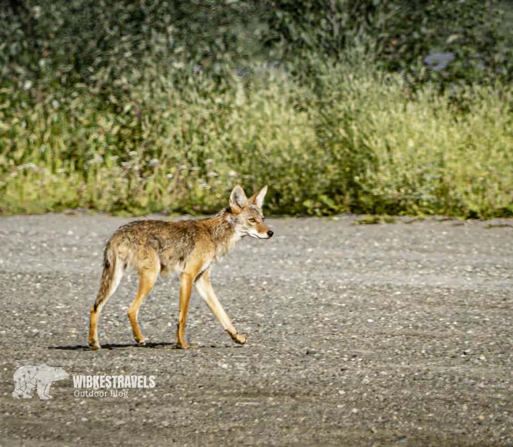
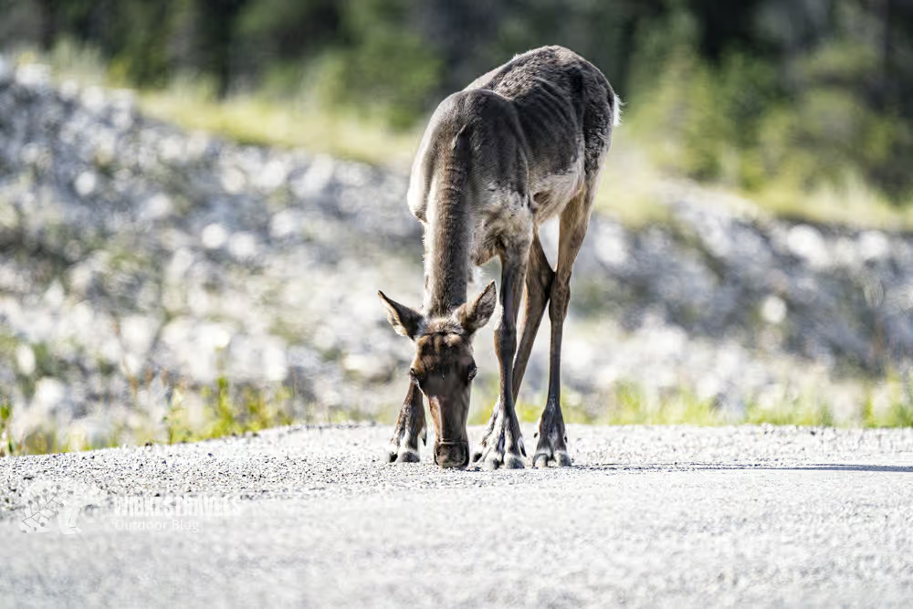
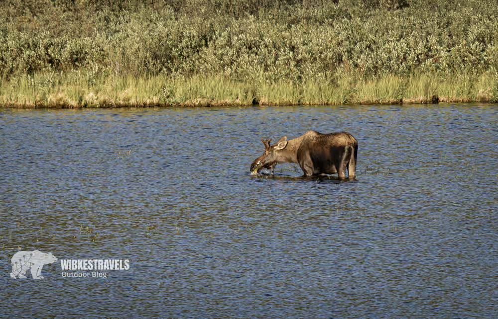
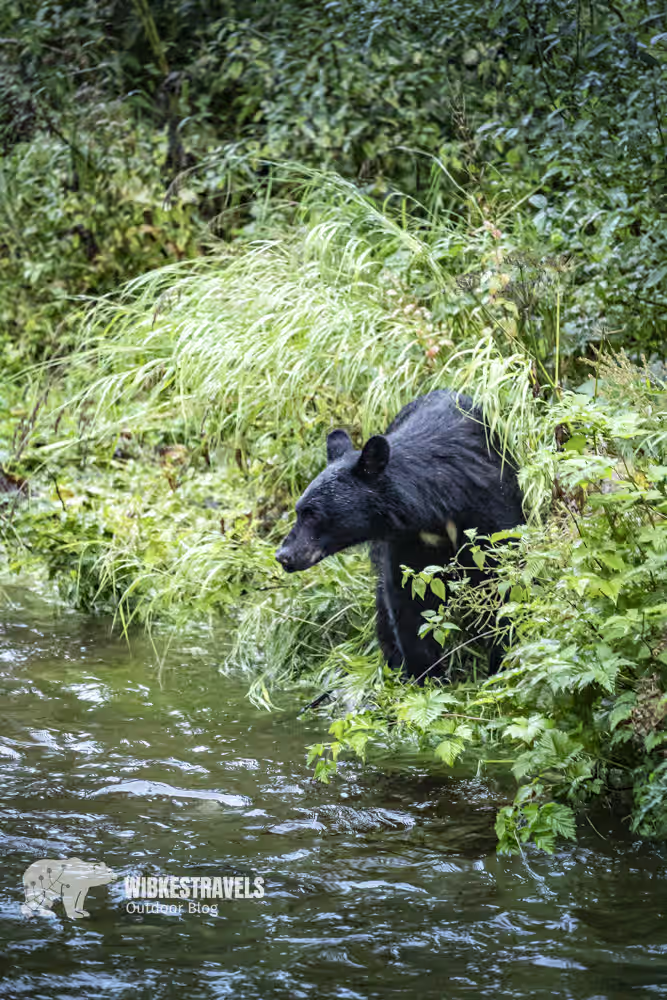
As a self-professed car hater, I normally don't like driving on the congested roads of Europe, yet I drove almost the entire stretch from Dawson Creek in British Columbia, Canada, to Delta Junction in Alaska. Why? In Canada, every kilometer is a revelation: dense coniferous forests line the road, only to suddenly reveal views of mountain peaks and azure lakes. I'm focused every second. Not just because of the breathtaking views—huge potholes also appear out of nowhere—but above all because of the animals that occasionally wander on and off the road. Here a moose, there a small reindeer, there a porcupine.
Driving in Canada is like watching a wildlife documentary in XXL format. The monitor is my windshield.
Click on the first image to start the photo gallery: alaska Highway Canada Highlight
My highlights on the Alaska Highway:
The road was built during World War II to connect the American mainland to Alaska via Canada. The highway is mostly paved and accessible year-round.
Highlight number 1: Mile 0
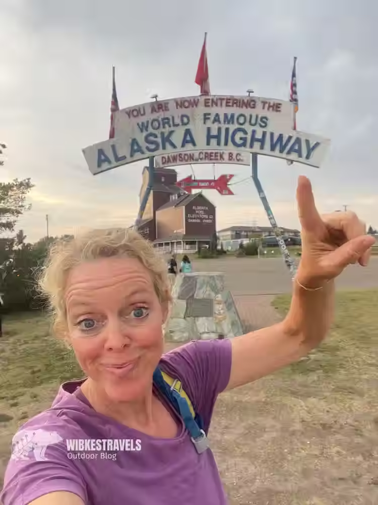
Dawson Creek is the starting point (mile marker 0) of the Alaska Highway and capitalizes on this with the Alaska Highway House ( www.tourismdawsoncreek.com ). The museum is located in an old building and offers a view of the mile marker. Of course, standing at Mile Marker 0 is a must.
And now the big ride begins: The first 600 kilometers are relatively flat. In Stone Mountain Provincial Park – about 140 kilometers west of Fort Nelson – you know why you're here: There are hiking trails with wild camping spots and a campground. I had already picked out many hikes, but unfortunately, it was pouring with rain when I arrived. So I continued in the pouring rain.
After another 75 kilometers, Muncho Lake Provincial Park begins .
It's known for its spruce forests, vast rolling hills, and the breathtaking landscapes surrounding the emerald-green lake of the same name. There are two campsites by the lake and a few lodges along the road. Unfortunately, it was still pouring here...

Highlight number 2 is the Liard River Hot Springs.
My absolute highlight of the day was the Liard River Hot Springs in the Liard River Provincial Park of the same name. It consists of a warm, humid ecosystem where 250 plant species thrive. After a long day in the car, I, too, blossomed here: From the campsite, you can walk to the hot springs and recover from the torture of the car ride.
I would love to see bison.
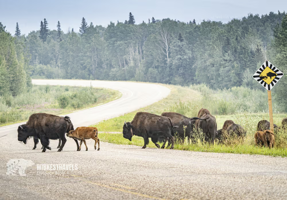
These huge, shaggy animals once populated the vast plains of North America. Around 100 years ago, they were almost extinct. Populations are slowly recovering. With a bit of luck, someone told me, I might see them near Watson Lake. As I took the obligatory selfie at the "Welcome to the Yukon" road sign , the lady at the gas station told me, "A huge herd passed by here earlier. Just follow the road and you'll see them."
Highlight number 3: living, once almost extinct bison!
Excited, I jump into the car and continue driving northeast. From a hilltop, I have a sweeping view all the way down to the Hyland River. Finally, I spot them: at least 50 animals, from small calves to stately bulls. They move leisurely along the road, plucking a tuft of grass here and there as they pass. A traffic jam has already formed, quite large by Yukon standards. About four or five cars are parked on the side of the road or are trying to pass at walking pace. A bridge crosses the river in front of us. With presence of mind, I drive to the other side. "With my big zoom lens, I can get good photos of them from this side too," I say happily. I can already see the bison slowly climbing down the embankment from the road. But contrary to my expectations, they don't stay on the bank. The entire herd plunges into the rushing river. The large animals struggle against the current, while four small calves are carried downstream. What was just pure joy now turns into panic. I can't stand by and watch the calves drown! Suddenly, I notice that one of the bulls has crossed the bridge and is now standing behind me. These animals are dangerous, so I jump into the shelter of my car. A short time later, the bull has disappeared, and right in front of me, the soaking wet, still somewhat embarrassed-looking little bison emerge from the water. By now, the entire herd has made it to the other side. They are shaking the water out of their thick fur in great cascades.
Completely enchanted, I stand on the shore and watch as the once almost extinct animals slowly reclaim their territory.
What a start to my visit to the Yukon!
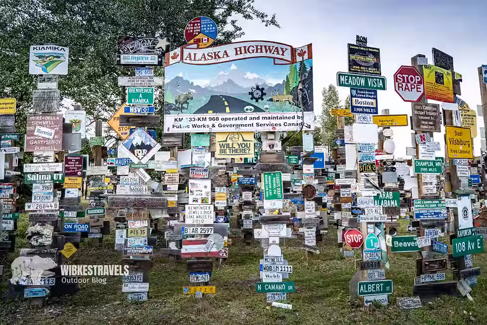
From here it is another 220 kilometers to Watson Lake in the Yukon Territory.
Named after British trapper Frank Watson, it is the first settlement on the Alaska Highway in the Yukon Territory. The city is famous for its " Sign Post Forest ." The first signpost, reading "Danville, Illinois," was erected in 1942. Gradually, more and more signs were added, and today there are over 77,000 from all over the world.
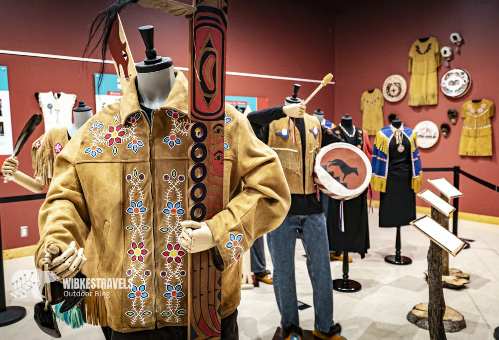
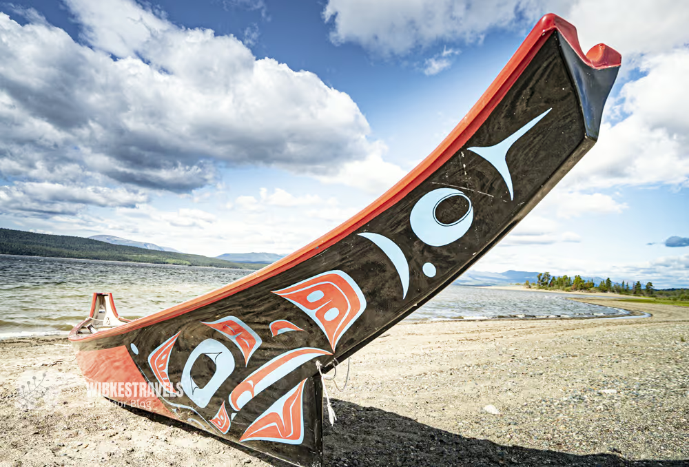
The Teslin Tlingit Heritage Centre was pretty deserted when I was there, but it's still worth a quick stop. There are five totem poles at the entrance, and inside is an exhibition of modern and traditional Tlingit art. Cultural events are sometimes held here. A traditional canoe is also located on the lakeshore.
Johnson's Crossing is located 50 kilometers northwest of Teslin and 127 kilometers south of Whitehorse, at the junction of the Alaska Highway and Canol Road (Highway 6). The Teslin River Bridge offers a magnificent view.
Highlight number 4: Whitehorse
Find out what to do in Whitehorse here .
From Whitehorse to Alaska
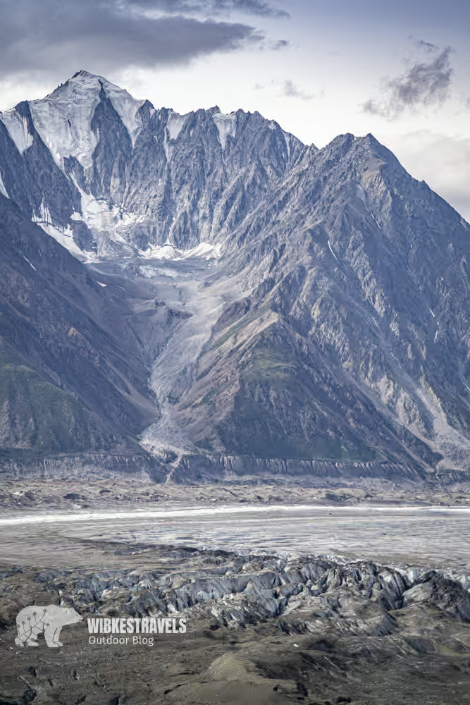
West of Whitehorse, the Alaska Highway is relatively flat until Haines Junction. The road runs parallel to the legendary Kluane National Park and the St. Elias Mountains.
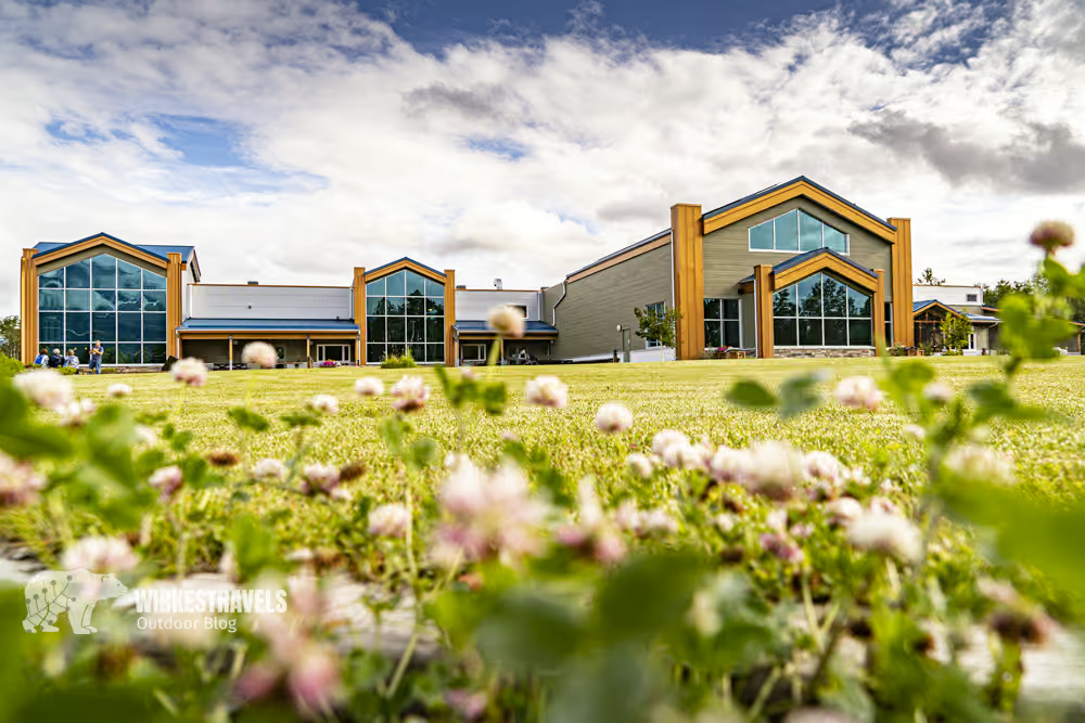
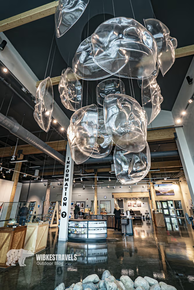
Highlight number 5: The Da Kų Cultural Center in Haines Junction
Haines Junction is the gateway to Kluane National Park. A mountain panorama with imposing peaks towers high above the town. This is the gateway to Kluane National Park, which is undoubtedly the main attraction, but the large, impressive Da Kų Cultural Centre features exhibits on the culture and history of the Champagne-Aishihik tribes and the national park . We spent a few hours there on a rainy day because we found it so fascinating.
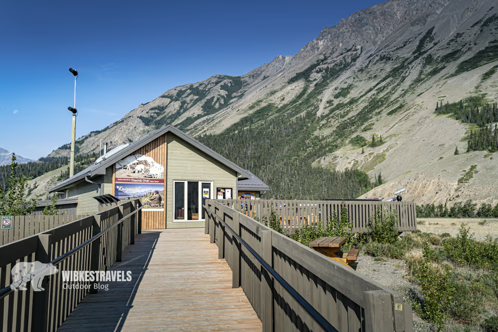
Highlight number 6: Kluane National Park
The Thechài Dhât Visitor Centre, overlooking Sheep Mountain, offers a wealth of information. You should visit it before every hike to check current conditions.
Here all the information & GPS data for the hike to Sheep Creek (will be online 3.7.25)
We drove along the Alaska Highway through Destruction Bay, Burwash Landing , and Beaver Creek to Tok , as we wanted to explore the Yukon . You can read about everything you can do there here .
Best time:
The best time to visit is during the summer months between June and August . This is when the days are longest, the weather is mild, and road conditions are good. Wildlife viewing is also particularly good, as many animals emerge from their hibernation and nature is in full bloom.
What you should do before traveling on the Alaska Highway:
1. Be offline
You'll have reception in very few places. So you can't rely on an online version of Google Maps or similar. You'll have to download all the data you need. This also applies to hikes.
2. Auto check-up
The Alaska Highway is characterized by long, lonely stretches of road. While this is a big part of its appeal, it also means that breaking down is especially frustrating, as you'll most likely have no cell reception. So you'll have to wait for the next car to arrive, which can take quite a while. Prevent breakdowns before they happen by taking your car to a mechanic before you set off.
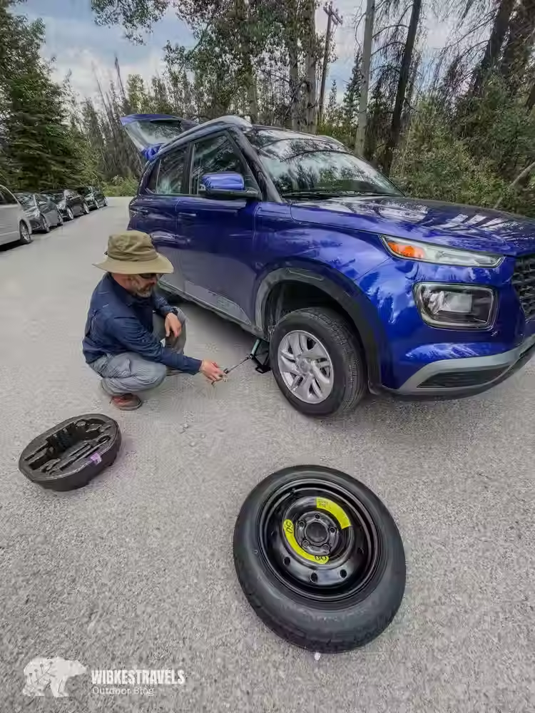
3. Be Prepared
Also, make sure you have emergency equipment for yourself and your car : a good set of jumper cables , a spare tire (plus a jack and wrench). Of course, you should also know how to change a tire. You can watch a YouTube video for this if necessary, and ideally, practice it in a safe environment. With a set of basic tools, you may be able to perform a quick repair and get your vehicle to the nearest populated area.
If you're stuck waiting, it's a good idea to have enough food supplies and something to keep you warm —even for the night in a worst-case scenario. A sleeping bag can be a lifesaver.
4. US visa
Don't forget: You need an ESTA visa to enter the United States . We ordered ours online and had it within 24 hours. However, if I needed it urgently, I'd probably leave a bit of a safety margin.


Comments