
Montenegro: Summit hike on Rumija – the highest mountain in the Dinaric Alps (incl. GPS)
- Oct 9, 2025
- 3 min read

Rumija is a panoramic mountain of exceptional quality . From its summit in Montenegro , you can see the Adriatic Sea , the Dinaric Alps , and the vast Lake Shkodra , which lies on the border with Albania.
Montenegro hike Rumija GPS
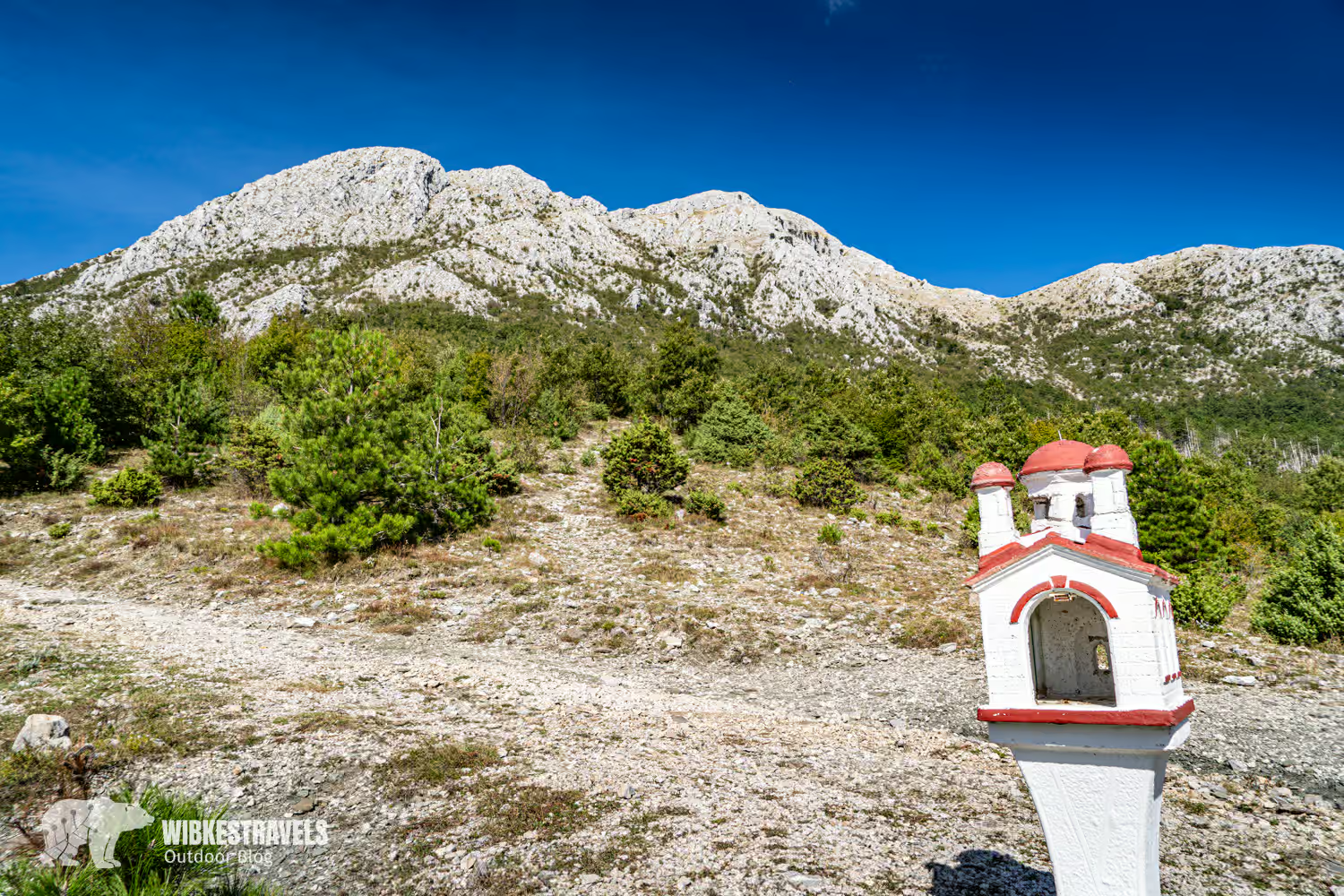
The hike isn't particularly technically demanding, but it's long and has a lot of elevation gain. It begins at the old city walls of Stari Bar , leads steadily uphill through dense forests and Mediterranean vegetation, past the Orthodox monastery , and through alpine terrain to the summit , which is crowned by a chapel . From there, you'll have a breathtaking panoramic view. Here's all the information you need, tips , and GPS data .
Click on the first image to start the photo gallery:

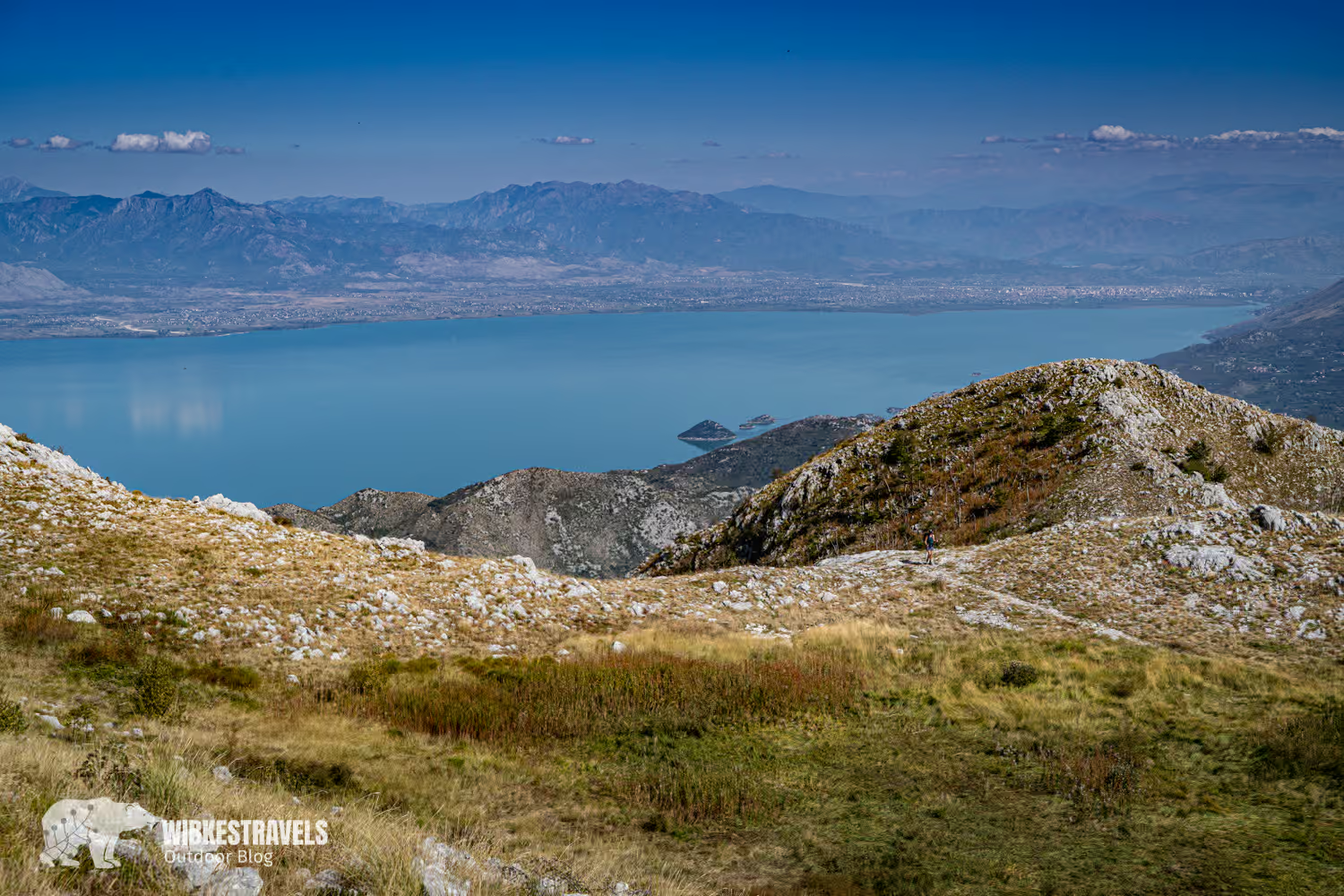
A beautiful hike with an obvious trail—not a given in the Balkans—and thanks to my GPS data, you'll definitely find the way without any problems.

Key Facts + GPS data for the summit hike on Rumija in Montenegro
♡ Factor: ♡♡♡♡♡
Walking time : 8 hours
Altitude : 1,538 m up and down
Length : 13.9 km
Accessible by public transport?
No.
Directions: Follow the small road out of Stari Bar heading north. Once you leave the houses behind you, there are several parking spaces on the left.
GPS data: I have uploaded the GPS data and detailed directions for the hike to the Outdooractive website .
Starting and ending point: Stari Bar
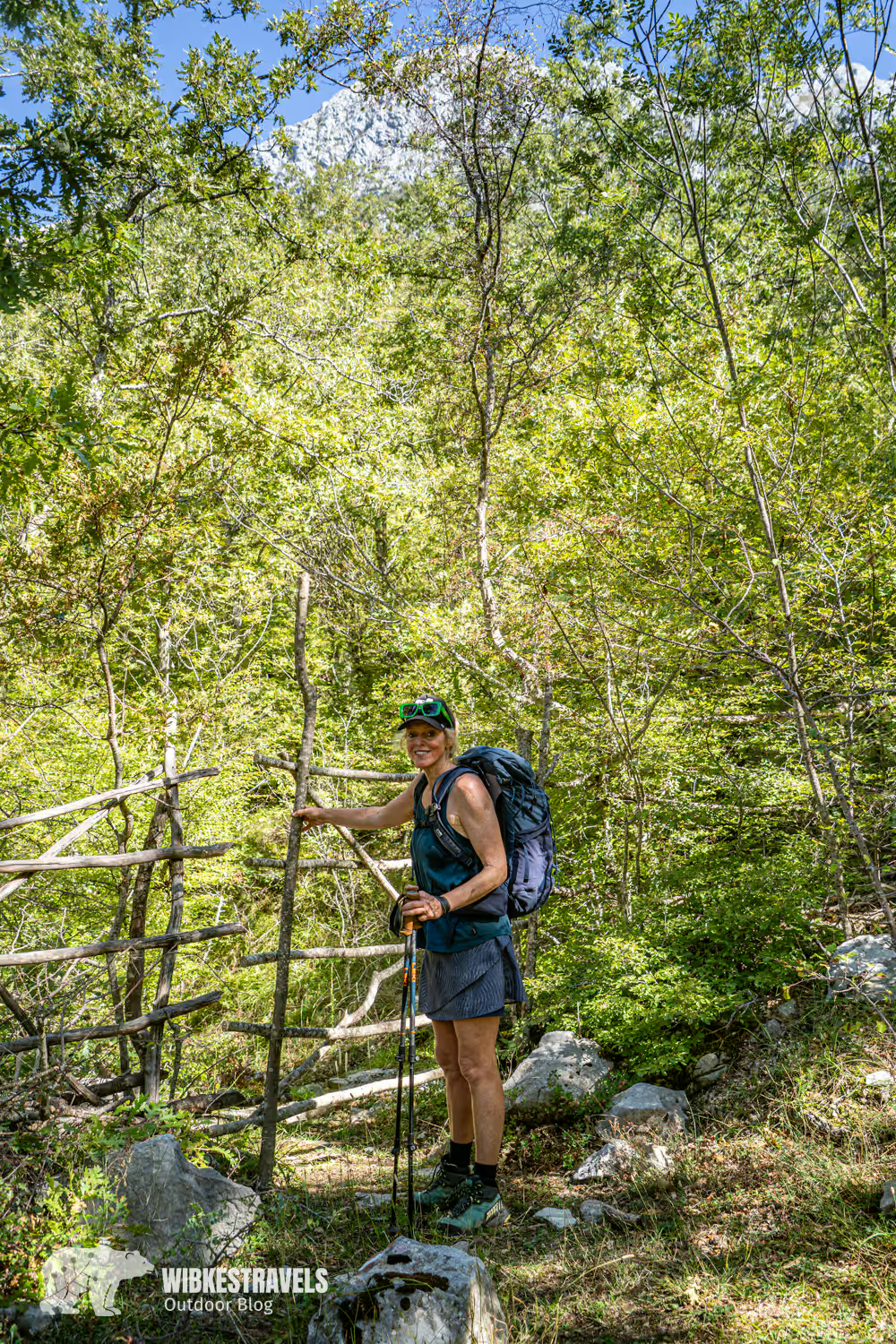
Equipment: For this hike, I recommend hiking boots or trail running shoes. Hiking poles can also be helpful. Bring plenty of water.

🏰 Start in the old town Stari Bar
The hike begins at the walls of the historic old town of Stari Bar, one of the oldest towns in Montenegro.
👉 My tip: In the old town there are many cozy restaurants where you can regain your strength after the hike.
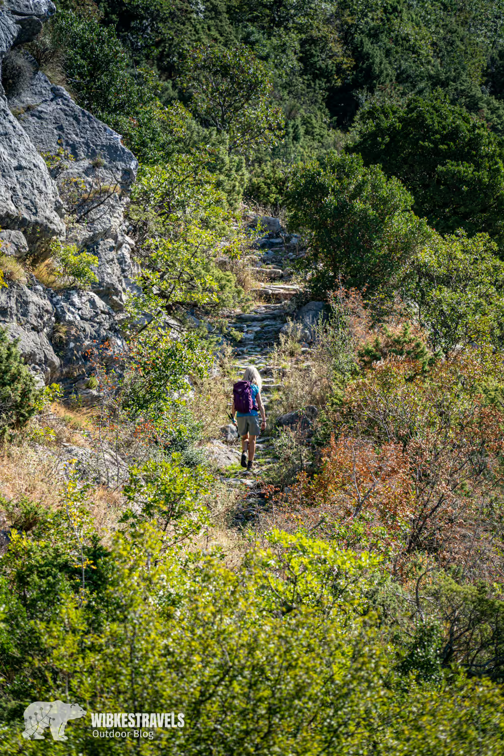
From there it goes uphill - first over old stone paths , then through shady beech and pine forests and finally over a mountain ridge to the summit .
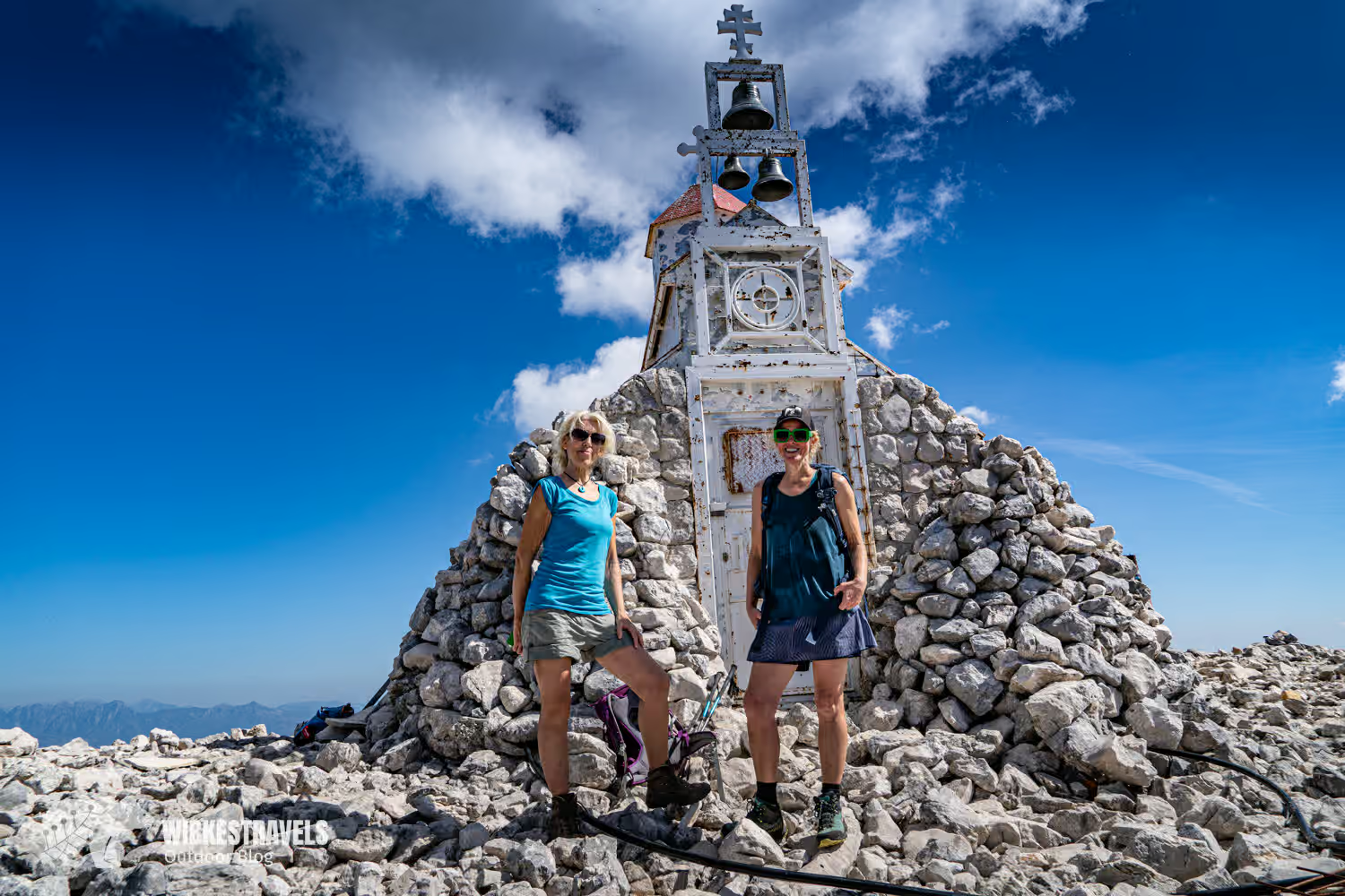
⛰️ The summit: Panorama over two worlds
Once you reach the top, a 360° panorama awaits you that is second to none: to the west you can see as far as the Adriatic Sea and the Bay of Bar , to the east you can see the huge Lake Shkodra in Albania.
⛪️ A chapel as a provocation
At the summit stands a small chapel dedicated to the Holy Trinity. It was flown to the summit by the Serbian Orthodox Church in June 2005 using an army helicopter . This action was controversial because it took place without permission from the Montenegrin authorities and was thus considered a provocation.

Despite all the political games, I found the chapel to be the perfect backdrop for a summit photo.
🧭 Safely to the summit with GPS
The route isn't marked throughout, which makes the GPX track I've provided all the more helpful. This allows you to follow the trail at your leisure without getting lost or constantly looking at a map.
👉 You can find the GPS track and detailed directions on Outdooractive .
♻️ One last request
Please remember: In many parts of Montenegro, waste disposal is still in its infancy. Use reusable water bottles, repack your trash, and leave no trace. This way, the wilderness stays wild – also for those who come after you.


Comments