
Slovenia: Fabulous 3-day hike to the summit of Triglav
- May 22, 2025
- 4 min read
Updated: May 23, 2025
This 3-day hike in the Triglav National Park is a challenging mountain trek with the summit of Slovenia's highest mountain. All information and GPS data here.

Every Slovenian should have stood on the country’s highest mountain at least once in their life.
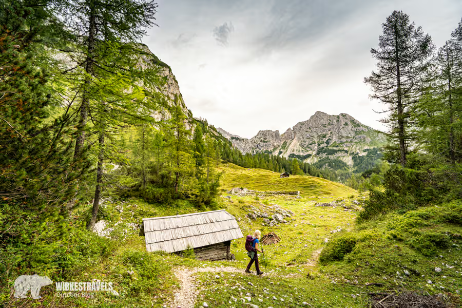
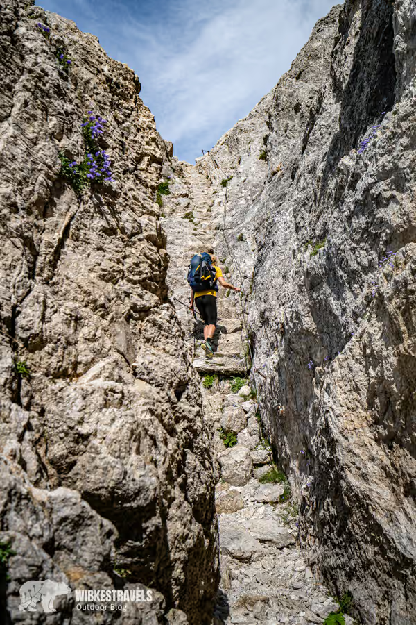
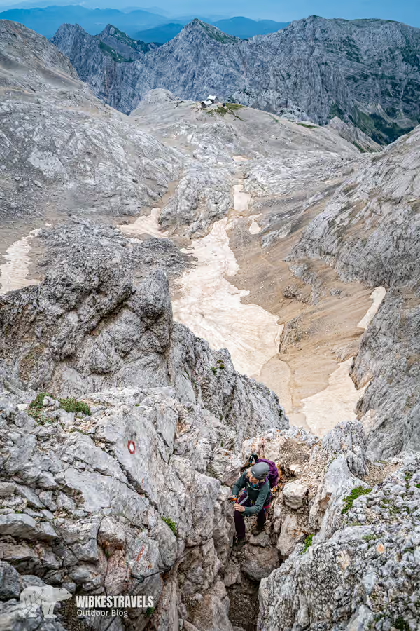
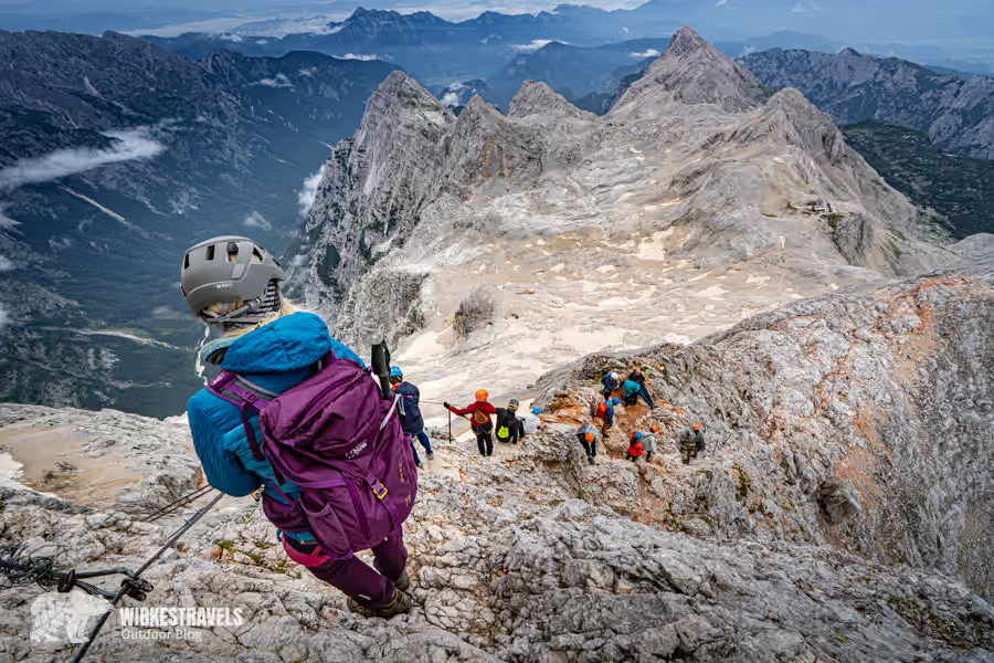
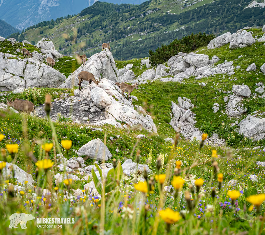
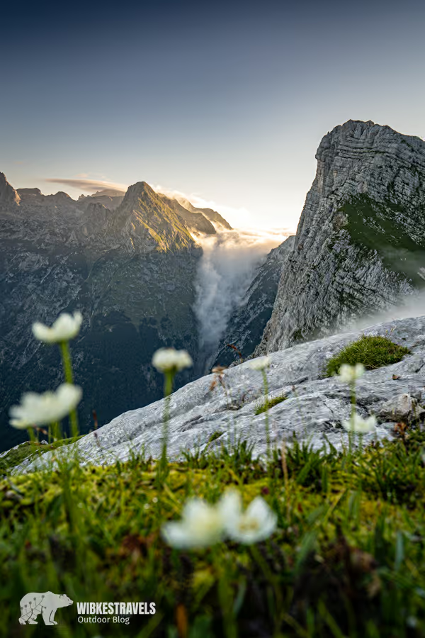
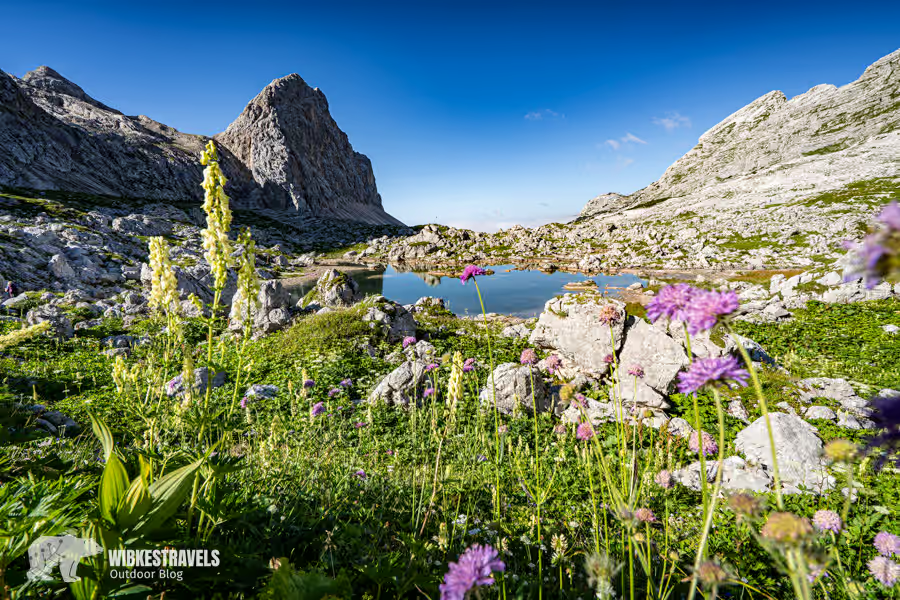
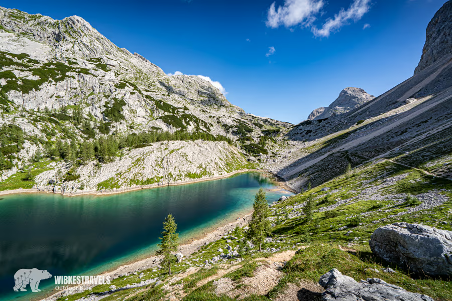
International mountaineers have now also discovered the peak for themselves. A hike to the highest summit in Triglav National Park in Slovenia is no longer an insider tip. At sunrise, a queue forms for the ascent to the summit. The climb requires mountaineering skills, via ferrata equipment, and a helmet. The final ascent is secured with steel cables. But once you've left the direct summit climbs behind you, the Julian Alps reveal their most beautiful side. In summer, colorful mountain meadows bloom. Chamois and wild mountain goats climb the rugged limestone cliffs, and marmots can be heard whistling in the distance. The highlight of this hike is an overnight stay in the small Zašavska Koča hut, with spectacular views of the mountains and lakes. The descent on the last day leads through the picturesque Valley of the Seven Lakes. A hike couldn't be more varied.
Key facts about the 3-day hike to the summit of Triglav in Slovenia

♡ Factor: ♡♡♡♡♡
Length : 35.3 km in total
Altitude : 2,232 m up and down
Accessible by public transport?
By shuttle bus, which departs just outside Stara Fužina on Lake Bohinj. This can be booked at the Tourist Office , Ribčev Laz 48, 4265 Lake Bohinj, Tel: +38645746010
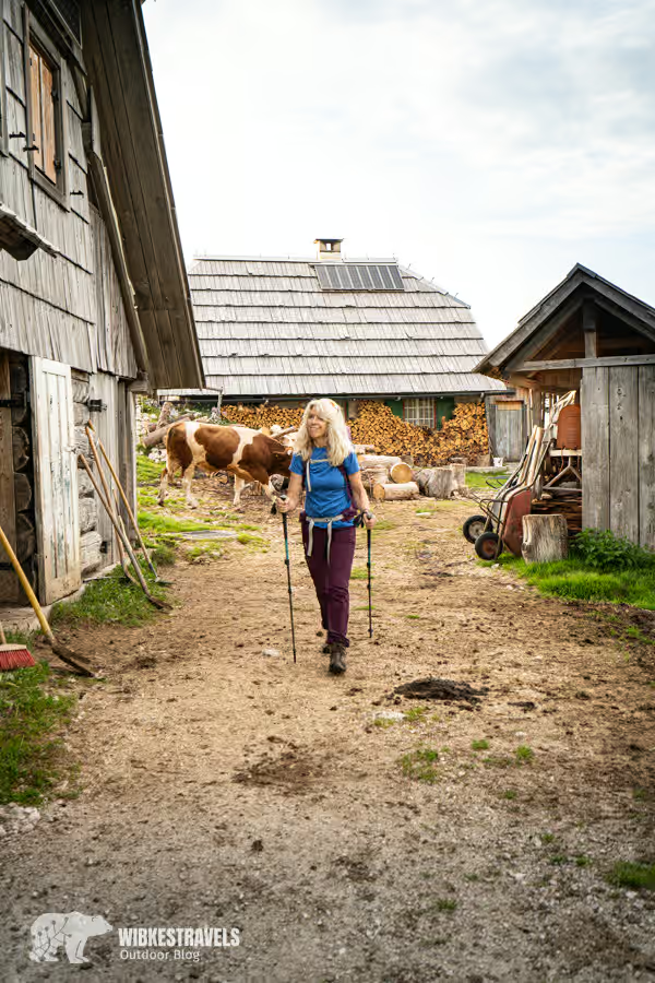
Directions: The starting point of the hike is the Planina Blato parking lot. This can only be reached via a toll road. The cost is €20 per day year-round.
GPS data: I have uploaded the GPS data for the hike to the Outdoor Active website
Starting and ending point: Planina Blato parking lot
Safety note: The ascent to the summit of Triglav should only be attempted by experienced mountaineers. A via ferrata set and helmet are required.
Equipment: Via ferrata set, helmet, hiking boots, warm clothing,
Booking the huts:
The huts of the Slovenian Alpine Club can be booked here .
The hike described in the article leads to Planika pod Triglavom on the first night and to the Zašavska koč a mountain hut on the second night . Both huts serve dinner and breakfast. Water is scarce. In summer, there is usually no running water (not even for washing hands), and drinking water must be purchased.
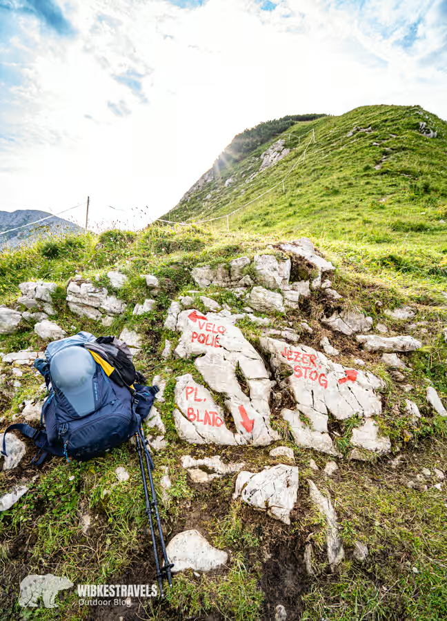
Daily stages:
Day 1: Planina Blato car park - Dom Planika pod Triglavom mountain hut
12km 7:30h, 1,420m ascent, 190m descent
The hike to this hut is quite challenging and should only be attempted by sure-footed and experienced hikers. The Dom Planika pod Triglavom mountain hut has no running water in the summer—not even for handwashing, so the sleeping bags and toilets smell accordingly. Drinking water must also be purchased.
The hut is certainly not my favorite accommodation, but it is strategically located.
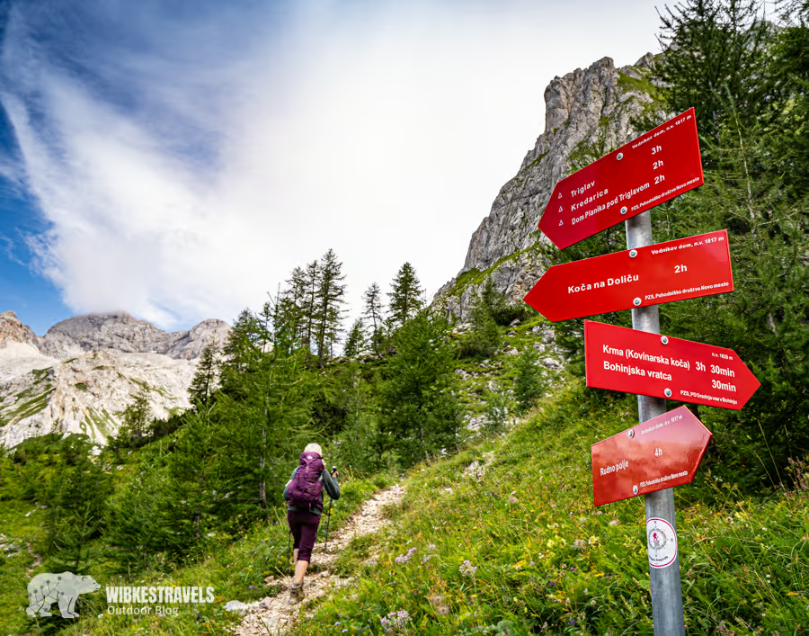


Day 2: Dom Planika pod Triglavom mountain hut with ascent of Triglav summit to Zašavska Koča hut
10 km 8:30, 630 m ascent, 970 m descent
The ascent to the summit should only be attempted by experienced mountaineers or with a hiking guide . A via ferrata set and a helmet are required , as the ascent to the summit is secured by wire ropes. We left our gear for the summit climb at the hut . Those who carry everything can descend directly to the Koča na Doliču Hut just below the summit. We ascended via the via ferrata and descended via the normal route.
If you don't have all of this or don't want to do it, you should descend directly from the hut to the next accommodation the next morning.
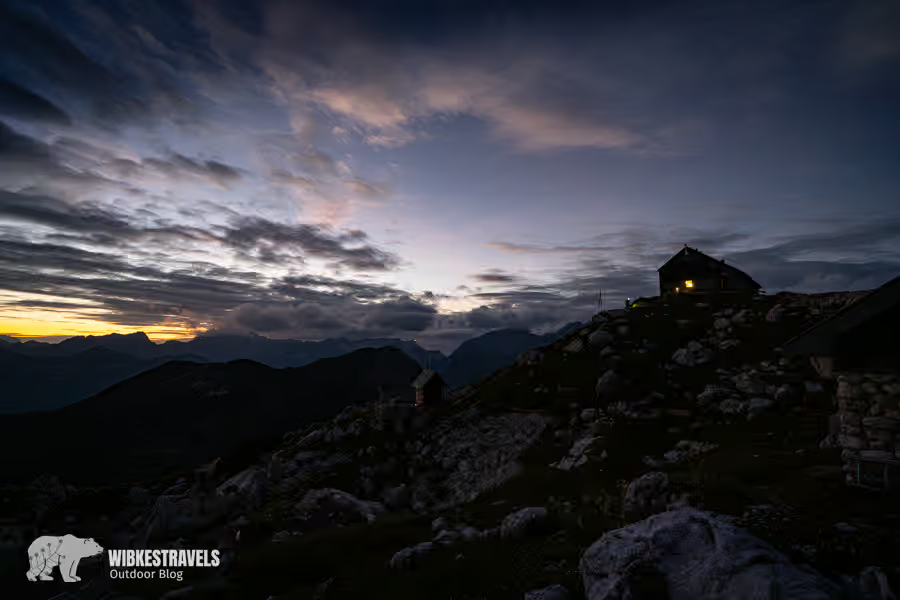
The next overnight stay, the Zašavska koča hut, is spectacularly situated on a rocky outcrop with a gigantic view of the surrounding mountains.

Day 3: Zašavska Koča Hut - Planina Blato Parking
12.8, 6:30 h, 220 m ascent, 1,130 descent
The last day takes you leisurely back to Planina Blato through the picture-book landscape of the seven lakes.
Temporary protection zone:
The area around Planina Krstencia is closed from 1 March to 1 July to protect the capercaillie, the rock ptarmigan, the black grouse, the chamois, the golden eagle and the raised bogs.
Information:

A guided hike to the summit of Triglav is offered by the DAV Summit Club
Julian Alps The most beautiful hikes and mountain tours can be found in the hiking guide of the Roher Bergverlag
General information on accommodation, restaurants, and activities can be found on the website of the Lake Bohinj Tourist Board . There you can also find information about current (weather) conditions in the mountains, Ribčev Laz 48, 4265 Lake Bohinj, Tel: +38645746010
You can find more tips for activities in the Balkans here .
Arrival:

By car, the journey from Heidelberg to Stara Fužina takes approximately 7 hours and 30 minutes. Public transport is available via the Slovenian capital, Ljubljana.
The starting point of the hike is the Planina Blato parking lot . This can only be reached via a toll road. The cost is €20 per day year-round. A more economical option is a shuttle bus that departs just outside Stara Fužina on Lake Bohinj. This can be booked at the tourist office. Ribčev Laz 48, 4265 Lake Bohinj, Tel: +38645746010
Safety notice:
The ascent to the summit of Triglav should only be attempted by experienced mountaineers. A via ferrata set and helmet are required. Less experienced hikers can skip the summit and descend from the Dom Planika pod Triglavom hut to the Zasavska Koca hut . The hike is technically easier, but surefootedness and a good level of fitness are still required.
Before you start your hike, you should definitely check the current conditions (either call the hut directly or ask at the tourist information office).
Here a video from our hike:


Comments